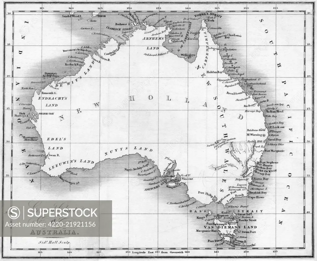
By this time the shape of the Australian continent is well enough known, but most has yet to be explored and various tracts are labelled as 'De Witts Land' and so on. Date: early 19th century
SuperStock offers millions of photos, videos, and stock assets to creatives around the world. This image of Explore Historical Australia: Vintage Map from the 18th Century Illustrating New Holland's Geographic Features by Mary Evans Picture Library/Pantheon is available for licensing today.
Looking for a license?
Click here, and we'll help you find it! Questions? Just ask!
Click here, and we'll help you find it! Questions? Just ask!
DETAILS
Image Number: 4220-21921156Rights ManagedCredit Line:Mary Evans Picture Library/Pantheon/SuperStockCollection:Mary Evans Picture Library Model Release:NoProperty Release:NoResolution:4800×3954