17th century Dutch East India Company map of the Strait of Magellan; a navigable sea route immediately south of mainland South America and north of Tierra del Fuego. Ferdinand Magellan (Portuguese: Fernío de Magalhíes), a Portuguese sailor in the service of Charles I of Spain, became the first European to navigate the strait in 1520 during his global circumnavigation voyage.
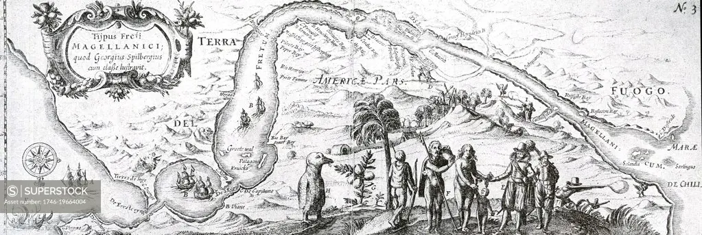
SuperStock offers millions of photos, videos, and stock assets to creatives around the world. This image of 17th century Dutch East India Company map of the Strait of Magellan; a navigable sea route immediately south of mainland South America and north of Tierra del Fuego. Ferdinand Magellan (Portuguese: Fernío de Magalhíes), a Portuguese sailor in the service of Charles I of Spain, became the first European to navigate the strait in 1520 during his global circumnavigation voyage. by World History Archive/Image Asset Management is available for licensing today.
Looking for a license?
Click here, and we'll help you find it! Questions? Just ask!
Click here, and we'll help you find it! Questions? Just ask!
DETAILS
Image Number: 1746-19664004Rights ManagedCredit Line:World History Archive/Image Asset Management/SuperStockCollection:Image Asset Management Contributor:World History Archive Model Release:NoProperty Release:NoResolution:5841×1960