Territory of the United States from the Mississippi River to the Pacific Ocean, prepared to accompany the reports of explorations for a Pacific Railroad route. Created in accordance with the 10th & 11th sections of the Army Appropriation Act of March 3rd, 1853. Issued in 1873 by the War Department in Washington, D.C. The map consists of 4 sheets measuring 108 x 117 cm, with individual sheets sized 59 x 63 cm and 57 x 63 cm. It covers themes such as railroads, explorations and surveys, and westward expansion in the United States
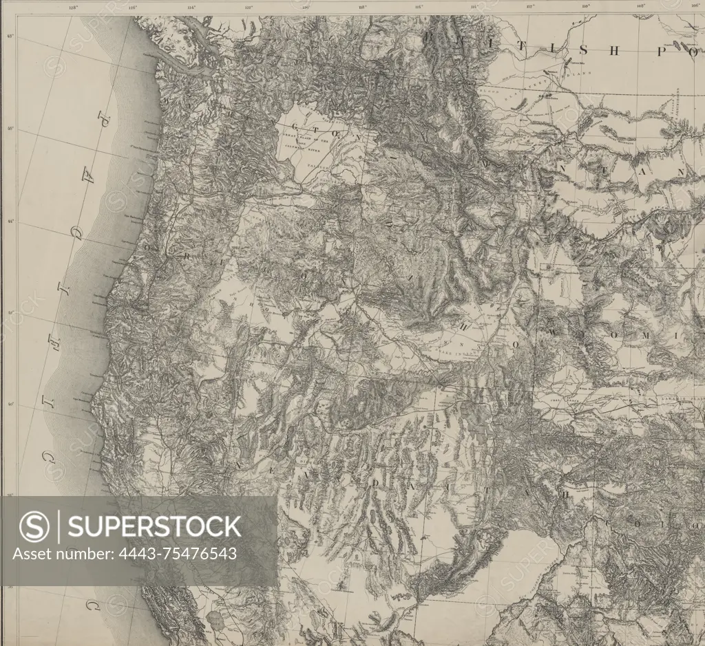
SuperStock offers millions of photos, videos, and stock assets to creatives around the world. This image of Territory of the United States from the Mississippi River to the Pacific Ocean, prepared to accompany the reports of explorations for a Pacific Railroad route. Created in accordance with the 10th & 11th sections of the Army Appropriation Act of March 3rd, 1853. Issued in 1873 by the War Department in Washington, D.C. The map consists of 4 sheets measuring 108 x 117 cm, with individual sheets sized 59 x 63 cm and 57 x 63 cm. It covers themes such as railroads, explorations and surveys, and westward expansion in the United States by Artokoloro is available for licensing today.
Looking for a license?
Click here, and we'll help you find it! Questions? Just ask!
Click here, and we'll help you find it! Questions? Just ask!
DETAILS
Image Number: 4443-75476543Rights ManagedCredit Line:Artokoloro/SuperStockCollection:Artokoloro Model Release:NoProperty Release:NoResolution:5700×5232