Tabula Peutingeriana or Peutinger Table. An illustrated itinerarium (ancient Roman road map) showing the layout of the road network of the Roman Empire. Painted on parchment, it is a medieval copy (13th century) of an original map of the 4th century. Detail of Italy. National Library of Vienna. Austria.
This asset has restrictions and cannot be purchased online. Get in touch for more details.
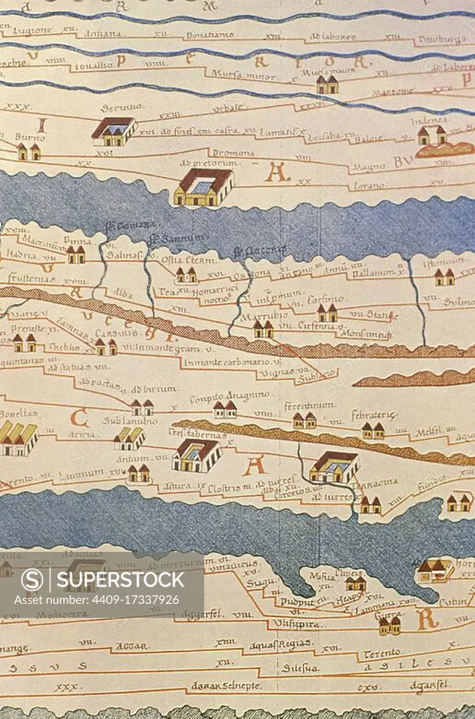
SuperStock offers millions of photos, videos, and stock assets to creatives around the world. This image of Tabula Peutingeriana or Peutinger Table. An illustrated itinerarium (ancient Roman road map) showing the layout of the road network of the Roman Empire. Painted on parchment, it is a medieval copy (13th century) of an original map of the 4th century. Detail of Italy. National Library of Vienna. Austria. by Album/Prisma/Album Archivo is available for licensing today.
Looking for a license?
Click here, and we'll help you find it! Questions? Just ask!
Click here, and we'll help you find it! Questions? Just ask!
DETAILS
Image Number: 4409-17337926Rights ManagedCredit Line:Album/Prisma/Album Archivo/SuperStockCollection:Album Archivo Contributor:Album / Prisma Model Release:NoProperty Release:NoResolution:3712×5610