Survey for a ship canal around the falls of Niagara, 1835. The map, measuring 73 x 118 cm on a sheet of 82 x 126 cm, illustrates an artificial harbor and a project for descent of a ridge. It is dated 1835 and was issued in Washington, D.C., though the publisher is not identified. The map details areas related to Canals in New York State, including Niagara Falls, Lewiston, Queenston, and the Niagara River, situated in both New York and Ontario, Canada
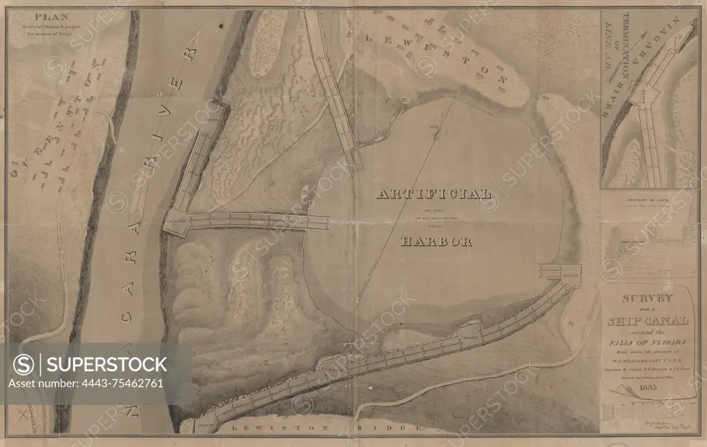
SuperStock offers millions of photos, videos, and stock assets to creatives around the world. This image of Survey for a ship canal around the falls of Niagara, 1835. The map, measuring 73 x 118 cm on a sheet of 82 x 126 cm, illustrates an artificial harbor and a project for descent of a ridge. It is dated 1835 and was issued in Washington, D.C., though the publisher is not identified. The map details areas related to Canals in New York State, including Niagara Falls, Lewiston, Queenston, and the Niagara River, situated in both New York and Ontario, Canada by Artokoloro is available for licensing today.
Looking for a license?
Click here, and we'll help you find it! Questions? Just ask!
Click here, and we'll help you find it! Questions? Just ask!
DETAILS
Image Number: 4443-75462761Rights ManagedCredit Line:Artokoloro/SuperStockCollection:Artokoloro Model Release:NoProperty Release:NoResolution:5700×3602