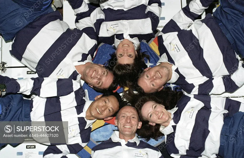
The STS-99 crew pose for a star-burst pose in celebration of a successful Shuttle Radar Topographic Mission (SRTM) aboard NASA's Space Shuttle Endeavor. Clockwise, around the circle, from top center are astronauts Janice Voss, Dominic L. Gorie, Janet L. Kavandi, Gerhard Thiele of the European Space Agency, Mamoru Mohri of the Japanese Space Agency, and Kevin Kregel. The STS-99 SRTM mission was the most ambitious Earth mapping mission to date. Orbiting at 233 kilometers (145 miles) above Earth, two radar anternas, one located in the Shuttle bay and the other located on the end of a 60-meter deployable mast, was used during the mission to map Earth's features. The goal was to provide a 3-dimensional topographic map of the world's surface up to the Arctic and Antarctic Circles. The mission completed 222 hours of around the clock radar mapping gathering enough information to fill more than 20,000 CDs.
SuperStock offers millions of photos, videos, and stock assets to creatives around the world. This image of The STS-99 crew pose for a star-burst pose in celebration of a successful Shuttle Radar Topographic Mission (SRTM) aboard NASA's Space Shuttle Endeavor. Clockwise, around the circle, from top center are astronauts Janice Voss, Dominic L. Gorie, Janet L. Kavandi, Gerhard Thiele of the European Space Agency, Mamoru Mohri of the Japanese Space Agency, and Kevin Kregel. The STS-99 SRTM mission was the most ambitious Earth mapping mission to date. Orbiting at 233 kilometers (145 miles) above Earth, two radar anternas, one located in the Shuttle bay and the other located on the end of a 60-meter deployable mast, was used during the mission to map Earth's features. The goal was to provide a 3-dimensional topographic map of the world's surface up to the Arctic and Antarctic Circles. The mission completed 222 hours of around the clock radar mapping gathering enough information to fill more than 20,000 CDs. by Piemags/PL Photography Limited is available for licensing today.
Looking for a license?
Click here, and we'll help you find it! Questions? Just ask!
Click here, and we'll help you find it! Questions? Just ask!
DETAILS
Image Number: 6145-44607520Royalty FreeCredit Line:Piemags/PL Photography Limited/SuperStockCollection:PL Photography Limited Contributor:Piemags Model Release:NoProperty Release:NoResolution:3000×1953