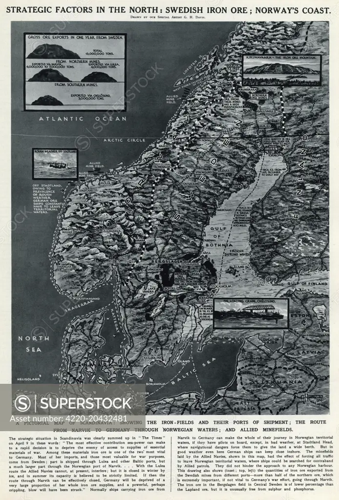
Strategic factors in the north: Swedish iron ore; Norway's coast. A pictorial map of Scandinavia, showing the iron fields and their ports of shipment, the route from Narvik to Germany through Norwegian waters, and Allied minefields. Date: 1940
SuperStock offers millions of photos, videos, and stock assets to creatives around the world. This image of Explore Nordic Strategic Factors: Historical Map of Scandinavia Highlighting Swedish Iron Ore and Norway's Coastline - An In-Depth Look at WWII Transport Routes and Military Significance. by Illustrated London News Ltd/Mary Evans Picture Library/Pantheon is available for licensing today.
Looking for a license?
Click here, and we'll help you find it! Questions? Just ask!
Click here, and we'll help you find it! Questions? Just ask!
DETAILS
Image Number: 4220-20432481Rights ManagedCredit Line:Illustrated London News Ltd/Mary Evans Picture Library/Pantheon/SuperStockCollection:Mary Evans Picture Library Contributor:Illustrated London News Ltd Model Release:NoProperty Release:NoResolution:4122×6076