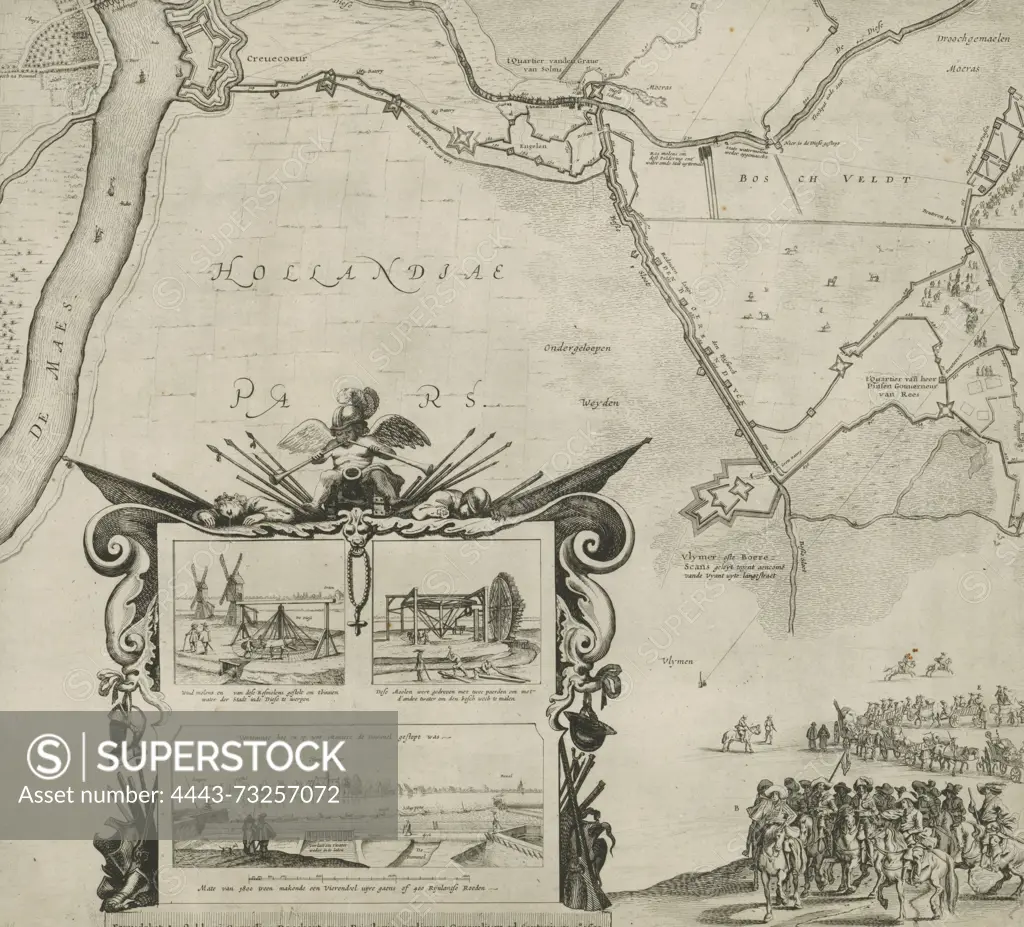
Staten-Generaal, Amsterdam, Danckerts, Cornelis (I), Rodenburgh, Jan Cornelis van, Siege and capture of Den Bosch by Frederik Hendrik, 1629, (sheet bottom left), Large map of the encirclement of Den Bosch during the siege by the Dutch army under Frederik Hendrik, from 1 May to 17 September 1629. Consisting of 4 plates and 4 text sheets. This is the sheet bottom left with part of the map and a large cartouche with details of two watermills and the damming of the Dommel., print, prent, nieuwsprent, prints, prenten, Frederik Muller Historieplaten, height 497 mm, width 555 mm, 1604-06-13 - 1656-04-27, print maker, prentmaker, 1630 - 1630, second quarter 17th century, paper, etching, etchings, surveyor, Publication (Event), Publication, publisher, granter of privilege
SuperStock offers millions of photos, videos, and stock assets to creatives around the world. This image of Staten-Generaal, Amsterdam, Danckerts, Cornelis (I), Rodenburgh, Jan Cornelis van, Siege and capture of Den Bosch by Frederik Hendrik, 1629, (sheet bottom left), Large map of the encirclement of Den Bosch during the siege by the Dutch army under Frederik Hendrik, from 1 May to 17 September 1629. Consisting of 4 plates and 4 text sheets. This is the sheet bottom left with part of the map and a large cartouche with details of two watermills and the damming of the Dommel., print, prent, nieuwsprent, prints, prenten, Frederik Muller Historieplaten, height 497 mm, width 555 mm, 1604-06-13 - 1656-04-27, print maker, prentmaker, 1630 - 1630, second quarter 17th century, paper, etching, etchings, surveyor, Publication (Event), Publication, publisher, granter of privilege by Artokoloro is available for licensing today.
Looking for a license?
Click here, and we'll help you find it! Questions? Just ask!
Click here, and we'll help you find it! Questions? Just ask!
DETAILS
Image Number: 4443-73257072Rights ManagedCredit Line:Artokoloro/SuperStockCollection:Artokoloro Model Release:NoProperty Release:NoResolution:4991×4519