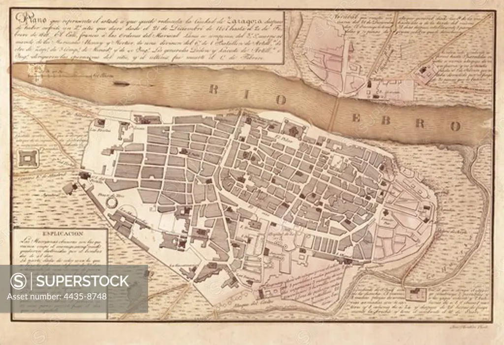
Spain. Peninsular War (1808-1814). Map of Saragossa after the second siege (December 1808-February 1809). From the work 'Atlas de la Guerra de Independencia' (1868). SPAIN. MADRID (AUTONOMOUS COMMUNITY). Madrid. National Library.
SuperStock offers millions of photos, videos, and stock assets to creatives around the world. This image of Spain. Peninsular War (1808-1814). Map of Saragossa after the second siege (December 1808-February 1809). From the work 'Atlas de la Guerra de Independencia' (1868). SPAIN. MADRID (AUTONOMOUS COMMUNITY). Madrid. National Library. by Iberfoto Archivo/Iberfoto is available for licensing today.
Looking for a license?
Click here, and we'll help you find it! Questions? Just ask!
Click here, and we'll help you find it! Questions? Just ask!
DETAILS
Image Number: 4435-8748Rights ManagedCredit Line:Iberfoto Archivo/Iberfoto/SuperStockCollection:Iberfoto Archivo Model Release:NoProperty Release:NoResolution:3648×2494