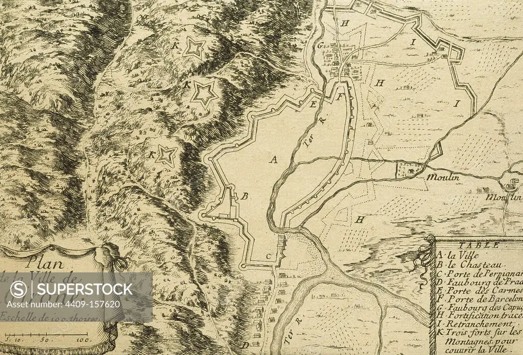
Spain. Catalonia. Girona. Plan of the city with walls and the river Ter. French engraving, made __during the negotiations of the spanish-french Treaty of the Pyrenees, 1659.
This asset has restrictions and cannot be purchased online. Get in touch for more details.
SuperStock offers millions of photos, videos, and stock assets to creatives around the world. This image of Explore the Historical Map of Girone: Discover Ancient Cartography and Historical Landmarks in This Vintage 18th Century French Map. by Album/Prisma/Album Archivo is available for licensing today.
Looking for a license?
Click here, and we'll help you find it! Questions? Just ask!
Click here, and we'll help you find it! Questions? Just ask!
DETAILS
Image Number: 4409-157620Rights ManagedCredit Line:Album/Prisma/Album Archivo/SuperStockCollection:Album Archivo Contributor:Album / Prisma Model Release:NoProperty Release:NoResolution:5079×3451