At Space Launch Complex 2 at Vandenberg Air Force Base in California, technicians prepare three poly picosatellite orbital deployers, or P-POD containers, with tiny satellites, called CubeSats inside, for installation on the direct mate adapter of the United Launch Alliance Delta II rocket, on Aug. 31, 2018. NASA's Ice, Cloud and land Elevation Satellite-2 (ICESat-2) is ready for launch aboard the final Delta II rocket. Launch is scheduled for Sept. 15, 2018. ICESat-2 will measure the height of a changing Earth, one laser pulse at a time, 10,000 laser pulses a second. The satellite will carry the Advanced Topographic Laser Altimeter System (ATLAS). ICESat-2 will help scientists investigate why, and how much our planet's frozen and icy areas, called the cryosphere, are changing in a warming climate.
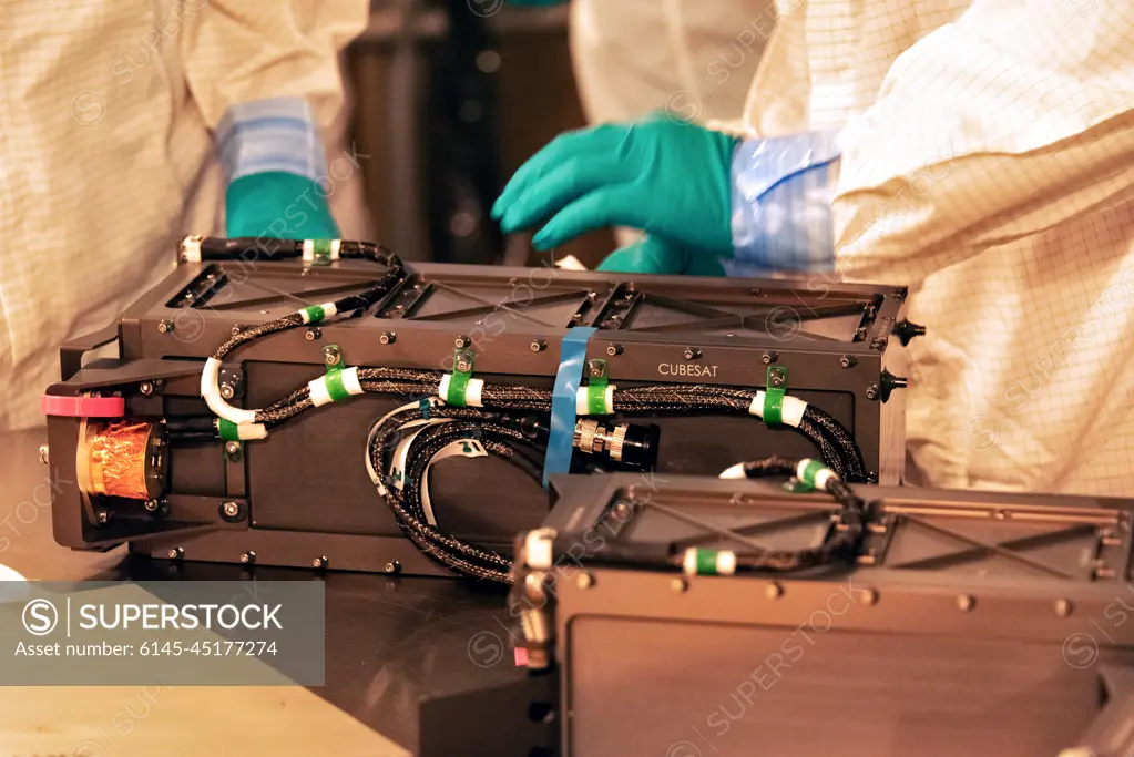
SuperStock offers millions of photos, videos, and stock assets to creatives around the world. This image of At Space Launch Complex 2 at Vandenberg Air Force Base in California, technicians prepare three poly picosatellite orbital deployers, or P-POD containers, with tiny satellites, called CubeSats inside, for installation on the direct mate adapter of the United Launch Alliance Delta II rocket, on Aug. 31, 2018. NASA's Ice, Cloud and land Elevation Satellite-2 (ICESat-2) is ready for launch aboard the final Delta II rocket. Launch is scheduled for Sept. 15, 2018. ICESat-2 will measure the height of a changing Earth, one laser pulse at a time, 10,000 laser pulses a second. The satellite will carry the Advanced Topographic Laser Altimeter System (ATLAS). ICESat-2 will help scientists investigate why, and how much our planet's frozen and icy areas, called the cryosphere, are changing in a warming climate. by Piemags/PL Photography Limited is available for licensing today.
Looking for a license?
Click here, and we'll help you find it! Questions? Just ask!
Click here, and we'll help you find it! Questions? Just ask!
DETAILS
Image Number: 6145-45177274Royalty FreeCredit Line:Piemags/PL Photography Limited/SuperStockCollection:PL Photography Limited Contributor:Piemags Model Release:NoProperty Release:NoResolution:7360×4912