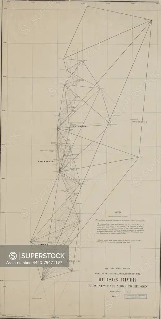
Sketch of the triangulation of the Hudson River from New Baltimore to Hudson, 1887. Issued by the New York State Survey, this map measures 88 x 45 cm and was lithographed by Weed, Parsons, & Co. It focuses on the surveying and triangulation along the Hudson River in New York and New Jersey
SuperStock offers millions of photos, videos, and stock assets to creatives around the world. This image of Sketch of the triangulation of the Hudson River from New Baltimore to Hudson, 1887. Issued by the New York State Survey, this map measures 88 x 45 cm and was lithographed by Weed, Parsons, & Co. It focuses on the surveying and triangulation along the Hudson River in New York and New Jersey by Artokoloro is available for licensing today.
Looking for a license?
Click here, and we'll help you find it! Questions? Just ask!
Click here, and we'll help you find it! Questions? Just ask!
DETAILS
Image Number: 4443-75471197Rights ManagedCredit Line:Artokoloro/SuperStockCollection:Artokoloro Model Release:NoProperty Release:NoResolution:2884×5700