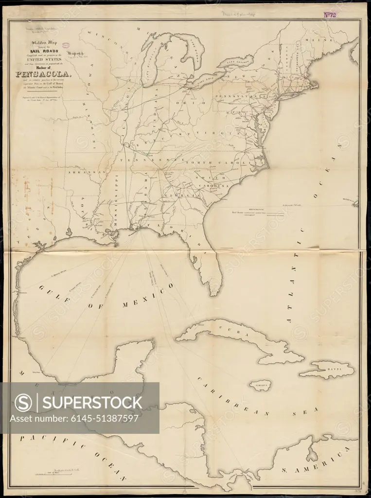
Skeleton map showing the rail roads completed and in progress in the United States and their connection as proposed with the harbor of Pensacola : and its relative position to the various important ports on the Gulf of Mexico, the Atlantic coast and in the West Indies , Railroads, United States, Maps, Trade routes, North America, Maps, United States, Maps Norman B. Leventhal Map Center Collection
SuperStock offers millions of photos, videos, and stock assets to creatives around the world. This image of Skeleton map showing the rail roads completed and in progress in the United States and their connection as proposed with the harbor of Pensacola : and its relative position to the various important ports on the Gulf of Mexico, the Atlantic coast and in the West Indies , Railroads, United States, Maps, Trade routes, North America, Maps, United States, Maps Norman B. Leventhal Map Center Collection by piemags/PL Photography Limited is available for licensing today.
Looking for a license?
Click here, and we'll help you find it! Questions? Just ask!
Click here, and we'll help you find it! Questions? Just ask!
DETAILS
Image Number: 6145-51387597Royalty FreeCredit Line:piemags/PL Photography Limited/SuperStockCollection:PL Photography Limited Story:Colonial American MapsContributor:piemags Model Release:NoProperty Release:NoResolution:11889×15940