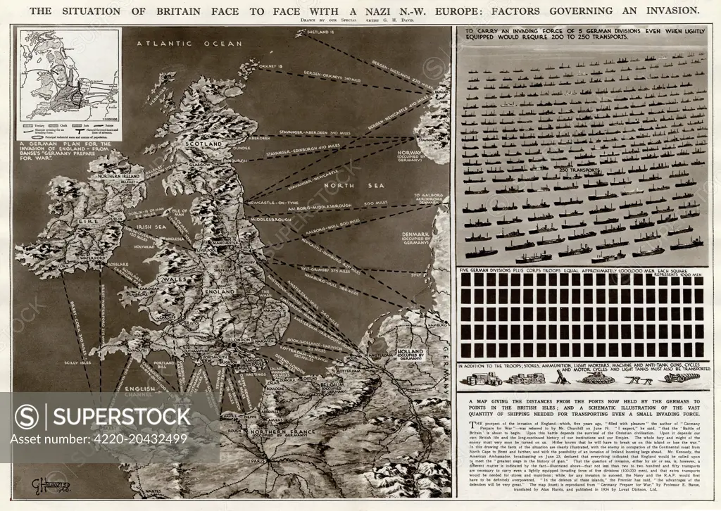
The situation of Britain face to face with a German north-west Europe: factors governing an invasion during the Second World War. A map giving the distances from the ports held by the Germans to points in the British Isles, and a schematic illustration of the vast quantity of shipping needed for transporting even a small invading force. Date: 1940
SuperStock offers millions of photos, videos, and stock assets to creatives around the world. This image of Explore Strategic Insights: World War II Map of Britain's Defense Against Nazi Invasion Plans by Illustrated London News Ltd/Mary Evans Picture Library/Pantheon is available for licensing today.
Looking for a license?
Click here, and we'll help you find it! Questions? Just ask!
Click here, and we'll help you find it! Questions? Just ask!
DETAILS
Image Number: 4220-20432499Rights ManagedCredit Line:Illustrated London News Ltd/Mary Evans Picture Library/Pantheon/SuperStockCollection:Mary Evans Picture Library Contributor:Illustrated London News Ltd Model Release:NoProperty Release:NoResolution:6405×4545