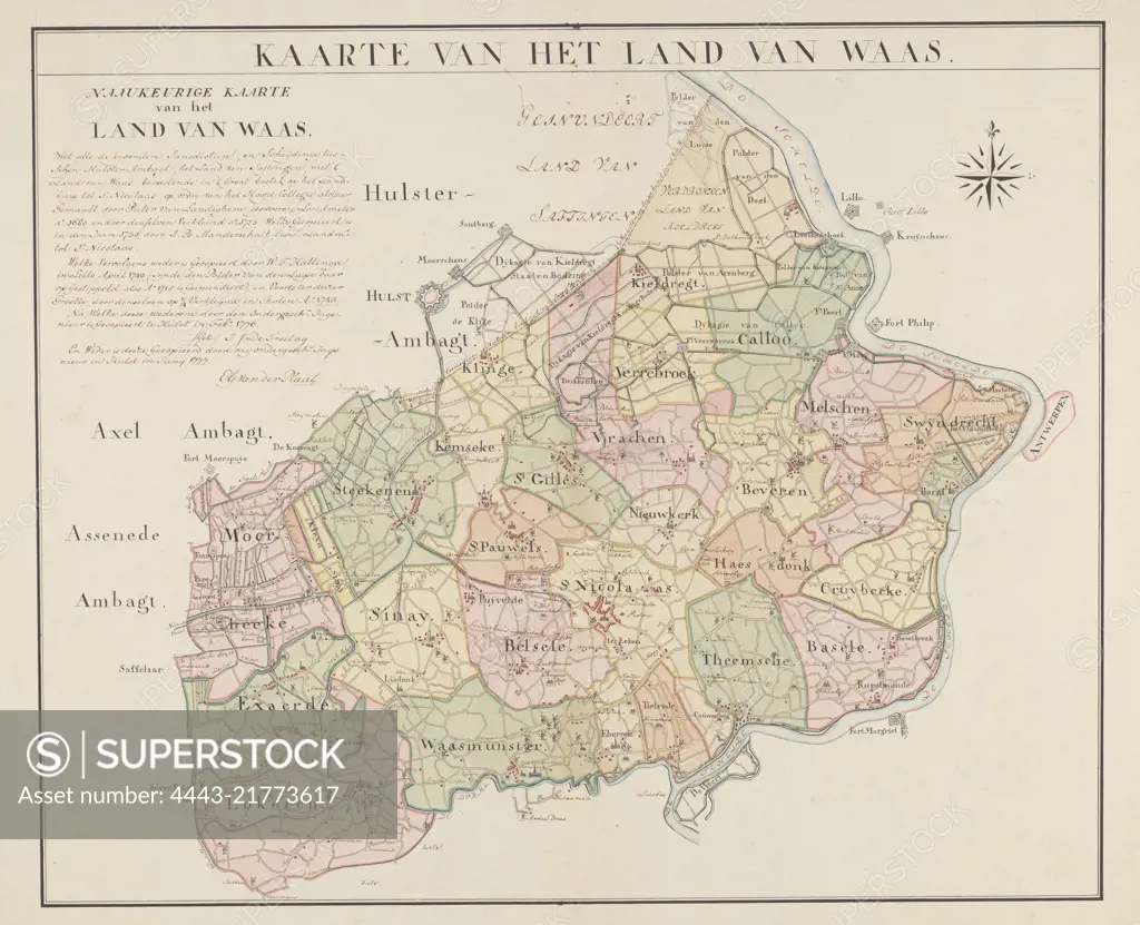
Signed map of Waasland. Top left a handwritten explanation about the map. The different districts are indicated with color, Map of the Waasland Map of the land of Waas., draughtsman: Engelbert George van der Plaat, (mentioned on object), Pieter van Landeghem, (mentioned on object), Hulst, 1777, paper, pen, brush, h 520 mm × w 665 mm
SuperStock offers millions of photos, videos, and stock assets to creatives around the world. This image of Signed map of Waasland. Top left a handwritten explanation about the map. The different districts are indicated with color, Map of the Waasland Map of the land of Waas., draughtsman: Engelbert George van der Plaat, (mentioned on object), Pieter van Landeghem, (mentioned on object), Hulst, 1777, paper, pen, brush, h 520 mm × w 665 mm by Artokoloro is available for licensing today.
Looking for a license?
Click here, and we'll help you find it! Questions? Just ask!
Click here, and we'll help you find it! Questions? Just ask!
DETAILS
Image Number: 4443-21773617Rights ManagedCredit Line:Artokoloro/SuperStockCollection:Artokoloro Model Release:NoProperty Release:NoResolution:5239×4254