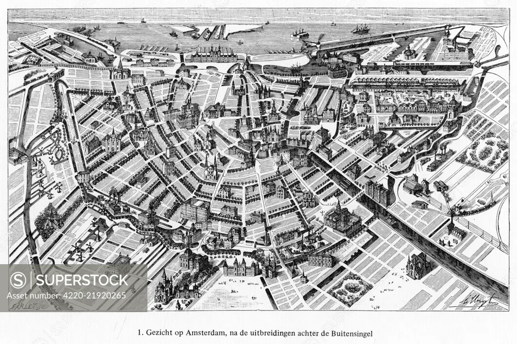
showing the layout of the concentric canals, traversed by radiating roads and bridges. Date: mid-19th century
SuperStock offers millions of photos, videos, and stock assets to creatives around the world. This image of Explore Historic Amsterdam: Vintage Map Illustration of the City's Expansive Canal Network by Mary Evans Picture Library/Pantheon is available for licensing today.
Looking for a license?
Click here, and we'll help you find it! Questions? Just ask!
Click here, and we'll help you find it! Questions? Just ask!
DETAILS
Image Number: 4220-21920265Rights ManagedCredit Line:Mary Evans Picture Library/Pantheon/SuperStockCollection:Mary Evans Picture Library Model Release:NoProperty Release:NoResolution:5387×3584