shaded relief image shows the extent of digital elevation data for Africa recently released by the Shuttle Radar Topography Mission (SRTM). Space Shuttle Endeavour in February 2000 and used an interferometric radar system to map the topography of Earths landmass between latitudes 56 degrees south and 60 degrees north. The data were processed into geographic tiles, each of which represents one by one degree of latitude and longitude. The northern part of the continent consists of a system of basins and plateaus, with several volcanic uplands whose uplift has been matched by subsidence in the large surrounding basins. Many of these basins have been in filled with sand and gravel, creating the vast Saharan lands. The Atlas Mountains in the northwest were created by convergence of the African and Eurasian tectonic plates. The geography of the central latitudes of Africa is dominated by the Great Rift Valley, extending from Lake Nyasa to the Red Sea, and splitting into two arms to enclos
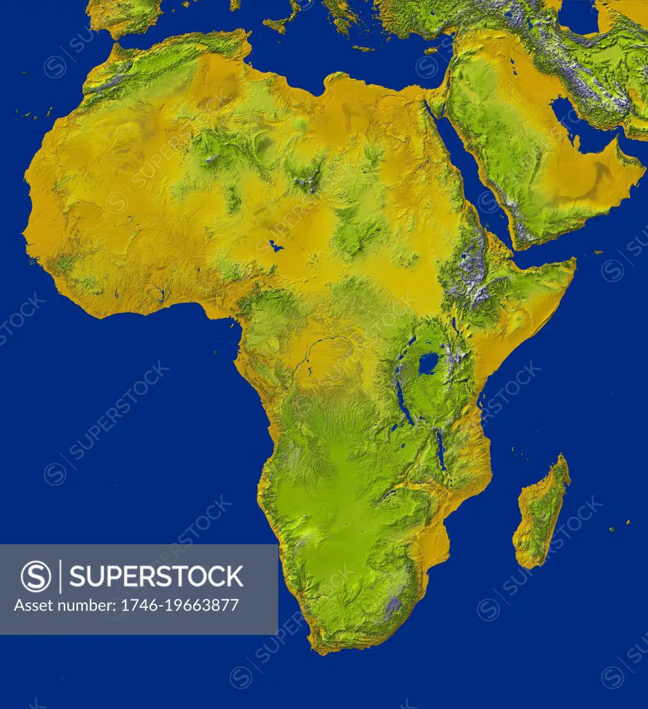
SuperStock offers millions of photos, videos, and stock assets to creatives around the world. This image of shaded relief image shows the extent of digital elevation data for Africa recently released by the Shuttle Radar Topography Mission (SRTM). Space Shuttle Endeavour in February 2000 and used an interferometric radar system to map the topography of Earths landmass between latitudes 56 degrees south and 60 degrees north. The data were processed into geographic tiles, each of which represents one by one degree of latitude and longitude. The northern part of the continent consists of a system of basins and plateaus, with several volcanic uplands whose uplift has been matched by subsidence in the large surrounding basins. Many of these basins have been in filled with sand and gravel, creating the vast Saharan lands. The Atlas Mountains in the northwest were created by convergence of the African and Eurasian tectonic plates. The geography of the central latitudes of Africa is dominated by the Great Rift Valley, extending from Lake Nyasa to the Red Sea, and splitting into two arms to enclos by World History Archive/Image Asset Management is available for licensing today.
Looking for a license?
Click here, and we'll help you find it! Questions? Just ask!
Click here, and we'll help you find it! Questions? Just ask!
DETAILS
Image Number: 1746-19663877Rights ManagedCredit Line:World History Archive/Image Asset Management/SuperStockCollection:Image Asset Management Contributor:World History Archive Model Release:NoProperty Release:NoResolution:5000×5469