Seven Years War (1756-1763). Combat of Grüningen (25 August 1762). Southeast-oriented map of the area between Grüningen, Holzheim and Langgöns in the principality of Solms. Map showing the positions of the Allied troops commanded by Hereditary Prince Ferdinand of Brunswick (red) and the French led by Louis-Joseph prince de Condé (1736-1818 (blue). This action was won by the Allied army. Published in 1765 by the cartographer Jean de Beaurain (1696-1771) as an illustration of his Great Map of Germany, with the events that took place during the War of the Seven Years. Etching and engraving. French edition, 1765. Military Historical Library of Barcelona (Biblioteca Histórico Militar de Barcelona). Catalonia. Spain. Author: Jean de Beaurain (1696-1771). French geographer.
This asset has restrictions and cannot be purchased online. Get in touch for more details.
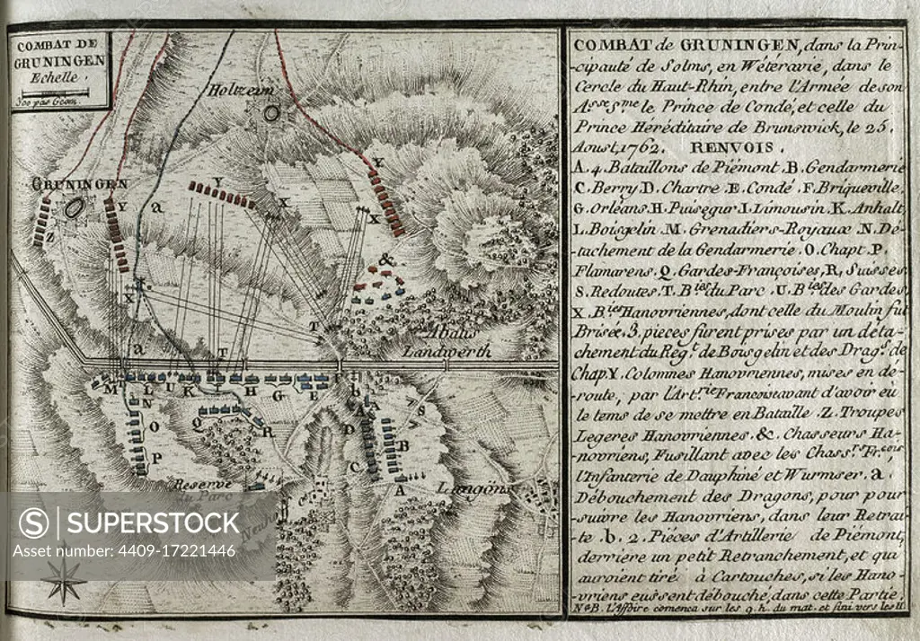
SuperStock offers millions of photos, videos, and stock assets to creatives around the world. This image of Seven Years War (1756-1763). Combat of Grüningen (25 August 1762). Southeast-oriented map of the area between Grüningen, Holzheim and Langgöns in the principality of Solms. Map showing the positions of the Allied troops commanded by Hereditary Prince Ferdinand of Brunswick (red) and the French led by Louis-Joseph prince de Condé (1736-1818 (blue). This action was won by the Allied army. Published in 1765 by the cartographer Jean de Beaurain (1696-1771) as an illustration of his Great Map of Germany, with the events that took place during the War of the Seven Years. Etching and engraving. French edition, 1765. Military Historical Library of Barcelona (Biblioteca Histórico Militar de Barcelona). Catalonia. Spain. Author: Jean de Beaurain (1696-1771). French geographer. by Album/Prisma/Album Archivo is available for licensing today.
Looking for a license?
Click here, and we'll help you find it! Questions? Just ask!
Click here, and we'll help you find it! Questions? Just ask!
DETAILS
Image Number: 4409-17221446Rights ManagedCredit Line:Album/Prisma/Album Archivo/SuperStockCollection:Album Archivo Contributor:Album / Prisma Model Release:NoProperty Release:NoResolution:4843×3375