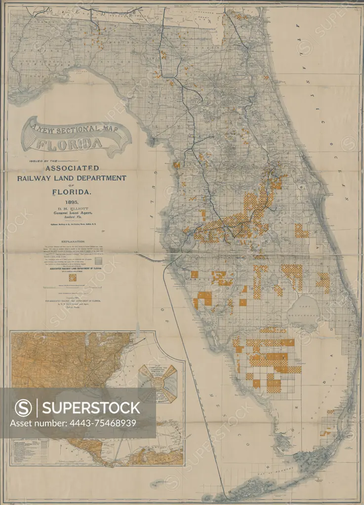
A sectional map of Florida from 1895, published by the Associated Railway Land Department of Florida. The map is in color and measures 110 x 78 cm, with the sheet dimensions being 113 x 81 cm. It includes details on real property, railroads, shipping, and the administrative and political divisions of Florida. The map was issued in Sanford, Florida
SuperStock offers millions of photos, videos, and stock assets to creatives around the world. This image of A sectional map of Florida from 1895, published by the Associated Railway Land Department of Florida. The map is in color and measures 110 x 78 cm, with the sheet dimensions being 113 x 81 cm. It includes details on real property, railroads, shipping, and the administrative and political divisions of Florida. The map was issued in Sanford, Florida by Artokoloro is available for licensing today.
Looking for a license?
Click here, and we'll help you find it! Questions? Just ask!
Click here, and we'll help you find it! Questions? Just ask!
DETAILS
Image Number: 4443-75468939Rights ManagedCredit Line:Artokoloro/SuperStockCollection:Artokoloro Model Release:NoProperty Release:NoResolution:4108×5700