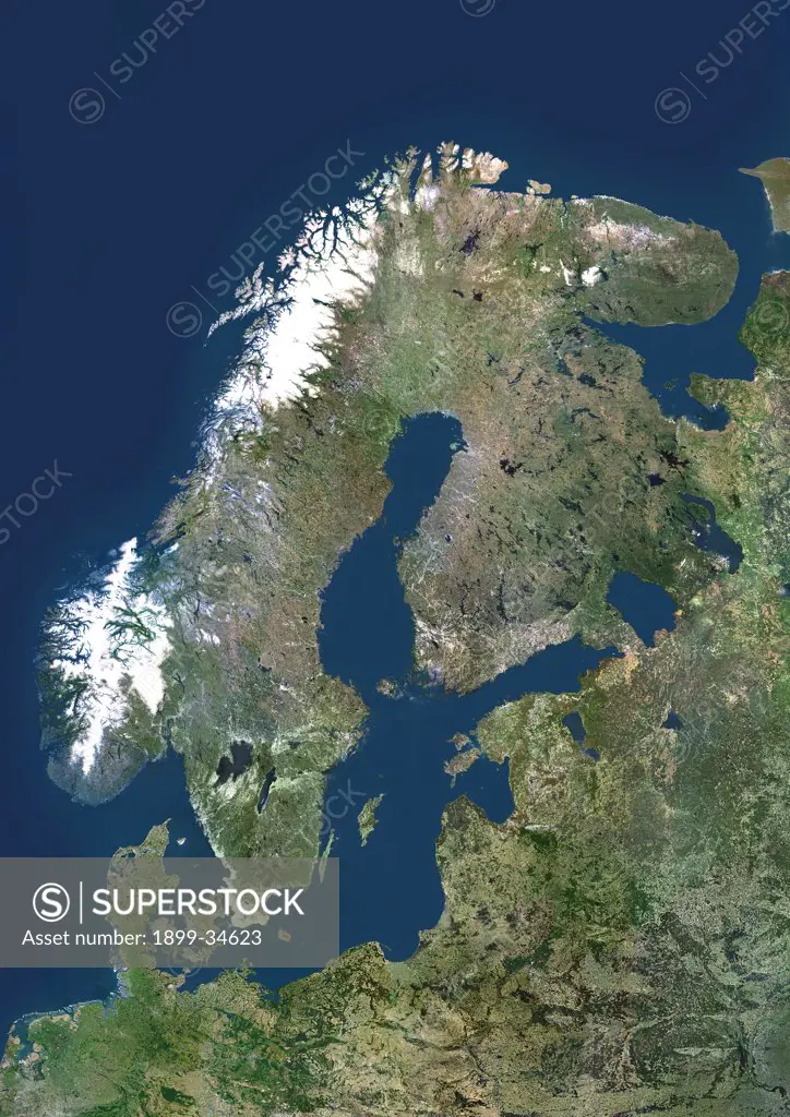
Scandinavia, True Colour Satellite Image. Scandinavia, true colour satellite image. The region comprises the countries of Norway (west coast of the peninsula at upper left), Sweden (on its east coast) and Denmark (small peninsula and islands west of southern Sweden). However, the term is often used to include Finland, across the Gulf of Bothnia to the east of Sweden. The Baltic Sea is at centre, with the thin Gulf of Finland (centre right) separating southern Finland from Estonia. Below Estonia
SuperStock offers millions of photos, videos, and stock assets to creatives around the world. This image of Scandinavia, True Colour Satellite Image. Scandinavia, true colour satellite image. The region comprises the countries of Norway (west coast of the peninsula at upper left), Sweden (on its east coast) and Denmark (small peninsula and islands west of southern Sweden). However, the term is often used to include Finland, across the Gulf of Bothnia to the east of Sweden. The Baltic Sea is at centre, with the thin Gulf of Finland (centre right) separating southern Finland from Estonia. Below Estonia by Universal Images is available for licensing today.
DETAILS
Image Number: 1899-34623Rights ManagedCredit Line:Universal Images/SuperStockCollection: