satellite view over Northern Australia, shows the northern portion of the Northern Territory, sometimes known as the Top End. There are also a few large islands visible, including Melville and Bathurst Islands to the north and the smaller Groote Eylandt to the east. The Timor Sea is to the west, with the Arafura Sea to the north, and the Gulf of Carpentaria to the east.
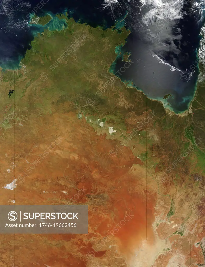
SuperStock offers millions of photos, videos, and stock assets to creatives around the world. This image of satellite view over Northern Australia, shows the northern portion of the Northern Territory, sometimes known as the Top End. There are also a few large islands visible, including Melville and Bathurst Islands to the north and the smaller Groote Eylandt to the east. The Timor Sea is to the west, with the Arafura Sea to the north, and the Gulf of Carpentaria to the east. by World History Archive/Image Asset Management is available for licensing today.
Looking for a license?
Click here, and we'll help you find it! Questions? Just ask!
Click here, and we'll help you find it! Questions? Just ask!
DETAILS
Image Number: 1746-19662456Rights ManagedCredit Line:World History Archive/Image Asset Management/SuperStockCollection:Image Asset Management Contributor:World History Archive Model Release:NoProperty Release:NoResolution:3700×4810