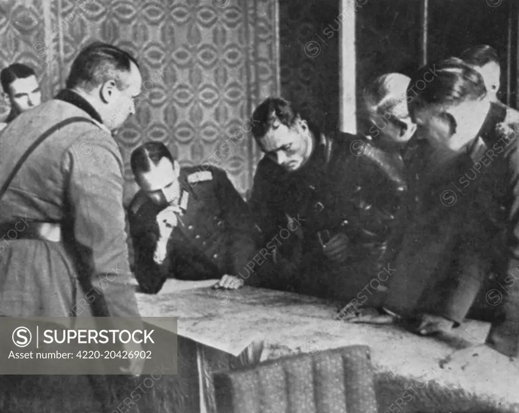
Russian Commander Borowenski bends over a map of Poland during discussions between German and Russian officers about the demarcation of the country following the invasion by Germany and Russia in September 1939. Date: 1939
SuperStock offers millions of photos, videos, and stock assets to creatives around the world. This image of World War II Strategy Meeting: Leaders Analyzing Military Maps for Tactical Planning by Illustrated London News Ltd/Mary Evans Picture Library/Pantheon is available for licensing today.
Looking for a license?
Click here, and we'll help you find it! Questions? Just ask!
Click here, and we'll help you find it! Questions? Just ask!
DETAILS
Image Number: 4220-20426902Rights ManagedCredit Line:Illustrated London News Ltd/Mary Evans Picture Library/Pantheon/SuperStockCollection:Mary Evans Picture Library Contributor:Illustrated London News Ltd Model Release:NoProperty Release:NoResolution:4600×3664