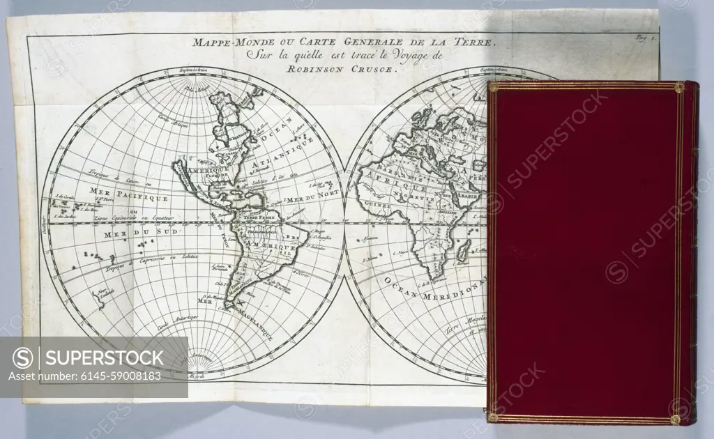
Robinson Crusoé "by Daniel Defoe (1660-1731), volume II: Mappemonde or general map of the earth on which is drawn the trip of Robinson Crusoe (view of the unfolded and flat board of the binding). Illustration of Bernard Picart (1673 -1733). Museum of Fine Arts of the City of Paris, Petit Palais. 33899-6 Geographical map, geography, illustration, world map, literary work, binding, land
SuperStock offers millions of photos, videos, and stock assets to creatives around the world. This image of Robinson Crusoé "by Daniel Defoe (1660-1731), volume II: Mappemonde or general map of the earth on which is drawn the trip of Robinson Crusoe (view of the unfolded and flat board of the binding). Illustration of Bernard Picart (1673 -1733). Museum of Fine Arts of the City of Paris, Petit Palais. 33899-6 Geographical map, geography, illustration, world map, literary work, binding, land by Piemags/PL Photography Limited is available for licensing today.
Looking for a license?
Click here, and we'll help you find it! Questions? Just ask!
Click here, and we'll help you find it! Questions? Just ask!
DETAILS
Image Number: 6145-59008183Royalty FreeCredit Line:Piemags/PL Photography Limited/SuperStockCollection:PL Photography Limited Contributor:Piemags Model Release:NoProperty Release:NoResolution:5100×3140