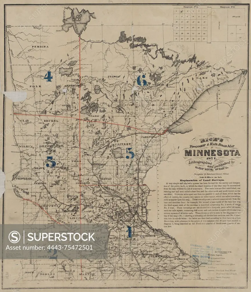
Rice's township and railroad map of Minnesota, created in 1871 by G. Jay Rice. The map is lithographed and published in St. Paul, Minnesota. It measures 45 x 38 cm on a sheet of 48 x 42 cm and features manuscript tracing and numbered regions in color. The map illustrates the railroads of Minnesota and its administrative and political divisions. The NYPL Map Division copy is imperfect, with small pieces of the map missing
SuperStock offers millions of photos, videos, and stock assets to creatives around the world. This image of Rice's township and railroad map of Minnesota, created in 1871 by G. Jay Rice. The map is lithographed and published in St. Paul, Minnesota. It measures 45 x 38 cm on a sheet of 48 x 42 cm and features manuscript tracing and numbered regions in color. The map illustrates the railroads of Minnesota and its administrative and political divisions. The NYPL Map Division copy is imperfect, with small pieces of the map missing by Artokoloro is available for licensing today.
Looking for a license?
Click here, and we'll help you find it! Questions? Just ask!
Click here, and we'll help you find it! Questions? Just ask!
DETAILS
Image Number: 4443-75472501Rights ManagedCredit Line:Artokoloro/SuperStockCollection:Artokoloro Model Release:NoProperty Release:NoResolution:4899×5700