Rice & Reed's township map of the state of Minnesota, 1870. The map is hand-colored and measures 46 x 39 cm. It was lithographed and published by Rice & Reed in St. Paul, Minnesota, and depicts the administrative and political divisions of the state
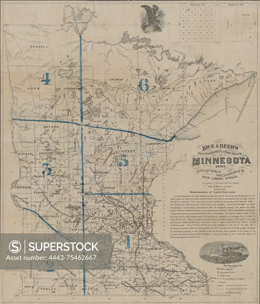
SuperStock offers millions of photos, videos, and stock assets to creatives around the world. This image of Rice & Reed's township map of the state of Minnesota, 1870. The map is hand-colored and measures 46 x 39 cm. It was lithographed and published by Rice & Reed in St. Paul, Minnesota, and depicts the administrative and political divisions of the state by Artokoloro is available for licensing today.
Looking for a license?
Click here, and we'll help you find it! Questions? Just ask!
Click here, and we'll help you find it! Questions? Just ask!
DETAILS
Image Number: 4443-75462667Rights ManagedCredit Line:Artokoloro/SuperStockCollection:Artokoloro Story:Topographical County MapsModel Release:NoProperty Release:NoResolution:4869×5700