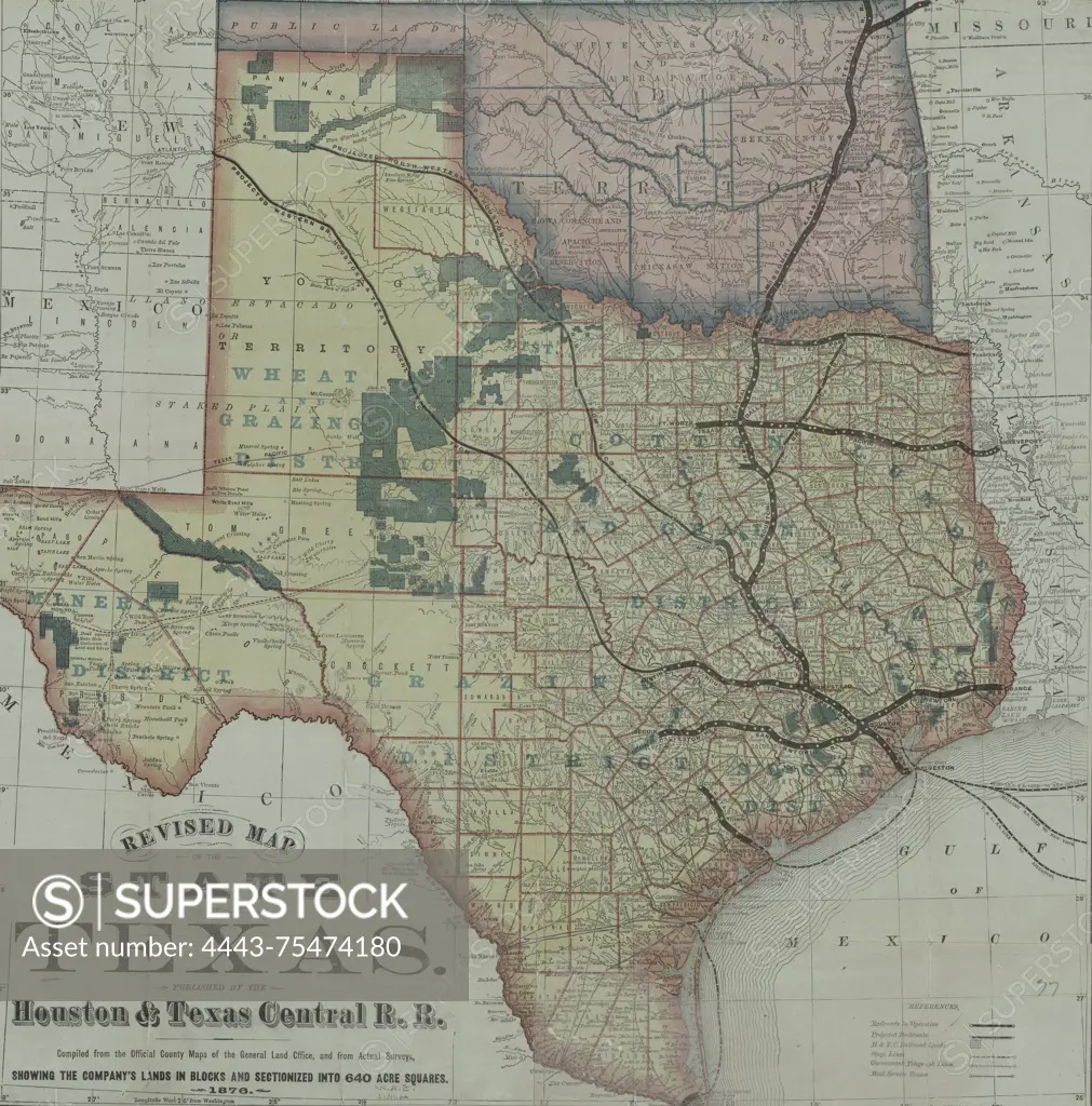
Revised map of the state of Texas published by the Houston & Texas Central R.R. Compiled from the official county maps of the General Land Office and actual surveys, this map shows the company's lands in blocks and sectionalized into 640-acre squares. The map includes postal services, post roads, and telegraph lines in Texas and Oklahoma, along with railroads and railroad land grants. Published in 1876 by the Houston & Texas Central Railway Company, the map measures 50 x 51 cm and is hand-colored
SuperStock offers millions of photos, videos, and stock assets to creatives around the world. This image of Revised map of the state of Texas published by the Houston & Texas Central R.R. Compiled from the official county maps of the General Land Office and actual surveys, this map shows the company's lands in blocks and sectionalized into 640-acre squares. The map includes postal services, post roads, and telegraph lines in Texas and Oklahoma, along with railroads and railroad land grants. Published in 1876 by the Houston & Texas Central Railway Company, the map measures 50 x 51 cm and is hand-colored by Artokoloro is available for licensing today.
Looking for a license?
Click here, and we'll help you find it! Questions? Just ask!
Click here, and we'll help you find it! Questions? Just ask!
DETAILS
Image Number: 4443-75474180Rights ManagedCredit Line:Artokoloro/SuperStockCollection:Artokoloro Model Release:NoProperty Release:NoResolution:5631×5700