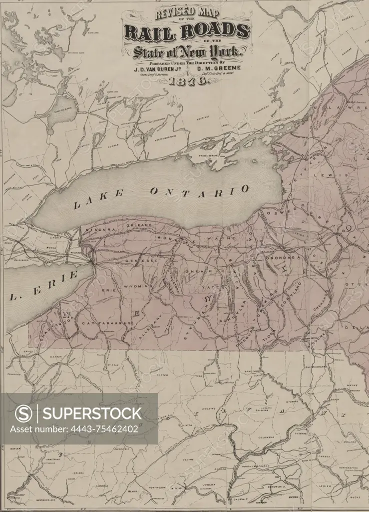
Revised map of the railroads of the State of New York, issued in 1876. The map measures 71 x 85 cm, with an overall sheet size of 79 x 89 cm. It is hand-colored and depicts the railroads and canals of New York, along with administrative and political divisions. The location of issuance is Albany, N.Y
SuperStock offers millions of photos, videos, and stock assets to creatives around the world. This image of Revised map of the railroads of the State of New York, issued in 1876. The map measures 71 x 85 cm, with an overall sheet size of 79 x 89 cm. It is hand-colored and depicts the railroads and canals of New York, along with administrative and political divisions. The location of issuance is Albany, N.Y by Artokoloro is available for licensing today.
Looking for a license?
Click here, and we'll help you find it! Questions? Just ask!
Click here, and we'll help you find it! Questions? Just ask!
DETAILS
Image Number: 4443-75462402Rights ManagedCredit Line:Artokoloro/SuperStockCollection:Artokoloro Model Release:NoProperty Release:NoResolution:4118×5700