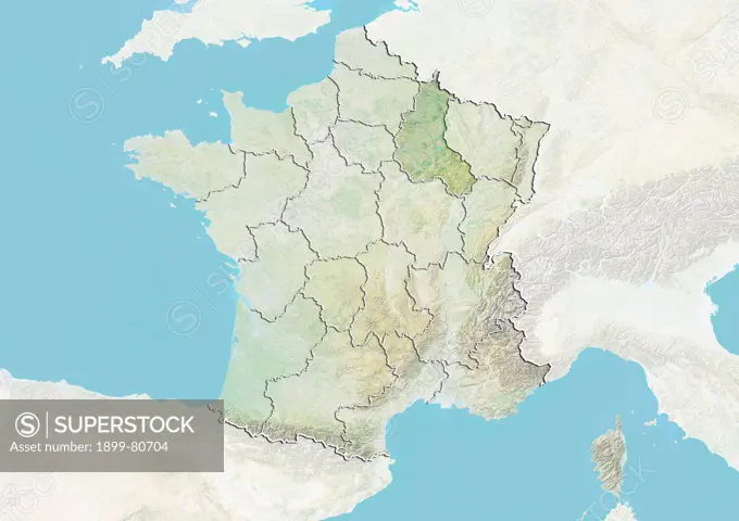
Relief map of France showing the region of Champagne-Ardenne. This image was compiled from data acquired by LANDSAT 5 & 7 satellites combined with elevation data.
SuperStock offers millions of photos, videos, and stock assets to creatives around the world. This image of Relief map of France showing the region of Champagne-Ardenne. This image was compiled from data acquired by LANDSAT 5 & 7 satellites combined with elevation data. by Universal Images is available for licensing today.
DETAILS
Image Number: 1899-80704Rights ManagedCredit Line:Universal Images/SuperStockCollection:Universal Images Model Release:NoProperty Release:NoResolution:4961×3511