relief image of Africa by the Shuttle Radar Topography Mission (SRTM). This release in 2000, includes data for all of the continent, plus the island of Madagascar and the Arabian Peninsula. The central latitudes of Africa is dominated by the Great Rift Valley, extending from Lake Nyasa to the Red Sea. To the west lies the Congo Basin. Most of the southern part of the continent rests on a concave plateau comprising the Kalahari basin. color-coding is directly related to topographic height, with brown and yellow at the lower elevations, rising through green, to white at the highest elevations. Blue areas on the map represent water within the mapped tiles, each of which includes shorelines or islands.
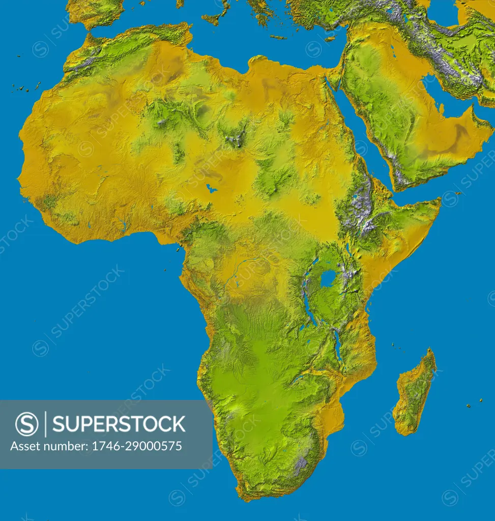
SuperStock offers millions of photos, videos, and stock assets to creatives around the world. This image of relief image of Africa by the Shuttle Radar Topography Mission (SRTM). This release in 2000, includes data for all of the continent, plus the island of Madagascar and the Arabian Peninsula. The central latitudes of Africa is dominated by the Great Rift Valley, extending from Lake Nyasa to the Red Sea. To the west lies the Congo Basin. Most of the southern part of the continent rests on a concave plateau comprising the Kalahari basin. color-coding is directly related to topographic height, with brown and yellow at the lower elevations, rising through green, to white at the highest elevations. Blue areas on the map represent water within the mapped tiles, each of which includes shorelines or islands. by World History Archive/Image Asset Management is available for licensing today.
Looking for a license?
Click here, and we'll help you find it! Questions? Just ask!
Click here, and we'll help you find it! Questions? Just ask!
DETAILS
Image Number: 1746-29000575Rights ManagedCredit Line:World History Archive/Image Asset Management/SuperStockCollection:Image Asset Management Contributor:World History Archive Model Release:NoProperty Release:NoResolution:4466×4696