A reduced map of the coasts and interior of the Florida peninsula, featuring the strait of the peninsula and the Bahamas Canal. Created in 1780 in France, the map is part of the collection at the Dépôt général de la marine in Paris. The map measures 58 x 40 cm on a sheet of 61 x 50 cm and includes nautical charts related to Florida, Cuba, and the Bahamas
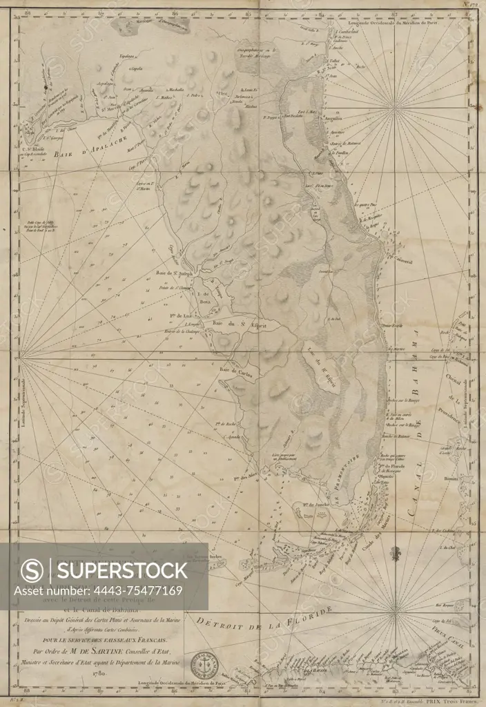
SuperStock offers millions of photos, videos, and stock assets to creatives around the world. This image of A reduced map of the coasts and interior of the Florida peninsula, featuring the strait of the peninsula and the Bahamas Canal. Created in 1780 in France, the map is part of the collection at the Dépôt général de la marine in Paris. The map measures 58 x 40 cm on a sheet of 61 x 50 cm and includes nautical charts related to Florida, Cuba, and the Bahamas by Artokoloro is available for licensing today.
Looking for a license?
Click here, and we'll help you find it! Questions? Just ask!
Click here, and we'll help you find it! Questions? Just ask!
DETAILS
Image Number: 4443-75477169Rights ManagedCredit Line:Artokoloro/SuperStockCollection:Artokoloro Model Release:NoProperty Release:NoResolution:3922×5700