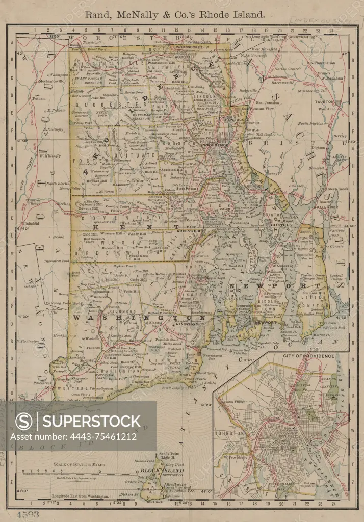
Rand, McNally & Co.'s Rhode Island, 1878. Rand, McNally and Co.'s indexed map of Rhode Island; Rhode Island., 1878., Chicago. Publisher, Rand, McNally & Co. Railroads in Rhode Island, Roads in Rhode Island, Administrative and political divisions in Rhode Island, Providence (R.I.)., 1 color map; 31 x 22 cm, designed to be folded to 16 x 9 cm
SuperStock offers millions of photos, videos, and stock assets to creatives around the world. This image of Rand, McNally & Co.'s Rhode Island, 1878. Rand, McNally and Co.'s indexed map of Rhode Island; Rhode Island., 1878., Chicago. Publisher, Rand, McNally & Co. Railroads in Rhode Island, Roads in Rhode Island, Administrative and political divisions in Rhode Island, Providence (R.I.)., 1 color map; 31 x 22 cm, designed to be folded to 16 x 9 cm by Artokoloro is available for licensing today.
Looking for a license?
Click here, and we'll help you find it! Questions? Just ask!
Click here, and we'll help you find it! Questions? Just ask!
DETAILS
Image Number: 4443-75461212Rights ManagedCredit Line:Artokoloro/SuperStockCollection:Artokoloro Model Release:NoProperty Release:NoResolution:3976×5700