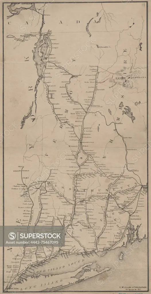
Railroad map of New England, issued between 1860 and 1869. The map measures 34 x 17 cm on a sheet of 36 x 19 cm. It was published by an unidentified publisher and lithographed by D. McLellan, located at 26 Spruce St., New York, N.Y. The map highlights railroads in New England
SuperStock offers millions of photos, videos, and stock assets to creatives around the world. This image of Railroad map of New England, issued between 1860 and 1869. The map measures 34 x 17 cm on a sheet of 36 x 19 cm. It was published by an unidentified publisher and lithographed by D. McLellan, located at 26 Spruce St., New York, N.Y. The map highlights railroads in New England by Artokoloro is available for licensing today.
Looking for a license?
Click here, and we'll help you find it! Questions? Just ask!
Click here, and we'll help you find it! Questions? Just ask!
DETAILS
Image Number: 4443-75467095Rights ManagedCredit Line:Artokoloro/SuperStockCollection:Artokoloro Model Release:NoProperty Release:NoResolution:2928×5700