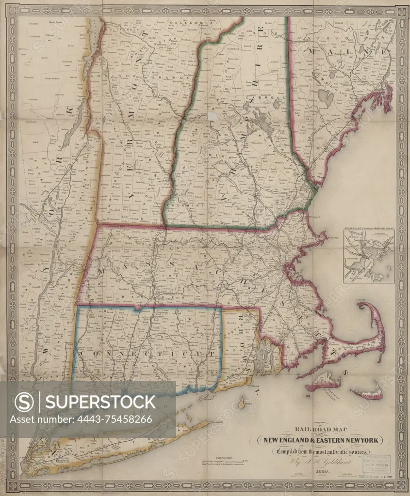
Railroad map of New England & eastern New York, compiled from the most authentic sources, issued in 1849 by Redding & Co. The map, measuring 58 x 47 cm, is hand colored and includes details about railroads in New England and New York. Published at 8 State St., Boston
SuperStock offers millions of photos, videos, and stock assets to creatives around the world. This image of Railroad map of New England & eastern New York, compiled from the most authentic sources, issued in 1849 by Redding & Co. The map, measuring 58 x 47 cm, is hand colored and includes details about railroads in New England and New York. Published at 8 State St., Boston by Artokoloro is available for licensing today.
Looking for a license?
Click here, and we'll help you find it! Questions? Just ask!
Click here, and we'll help you find it! Questions? Just ask!
DETAILS
Image Number: 4443-75458266Rights ManagedCredit Line:Artokoloro/SuperStockCollection:Artokoloro Story:Historic Railroad MapsModel Release:NoProperty Release:NoResolution:4709×5700