Railroad map of Michigan, issued in 1876 by the Commissioner of Railroads. The map is hand colored and measures 58 x 40 cm, mounted on a sheet measuring 62 x 43 cm. It includes details on railroads and administrative and political divisions in Michigan, including the Upper Peninsula. An accession number is stamped in the lower left corner 61295
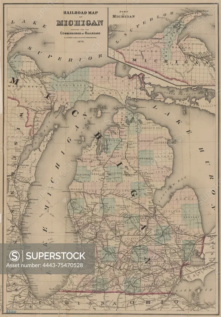
SuperStock offers millions of photos, videos, and stock assets to creatives around the world. This image of Railroad map of Michigan, issued in 1876 by the Commissioner of Railroads. The map is hand colored and measures 58 x 40 cm, mounted on a sheet measuring 62 x 43 cm. It includes details on railroads and administrative and political divisions in Michigan, including the Upper Peninsula. An accession number is stamped in the lower left corner 61295 by Artokoloro is available for licensing today.
Looking for a license?
Click here, and we'll help you find it! Questions? Just ask!
Click here, and we'll help you find it! Questions? Just ask!
DETAILS
Image Number: 4443-75470528Rights ManagedCredit Line:Artokoloro/SuperStockCollection:Artokoloro Model Release:NoProperty Release:NoResolution:3984×5700