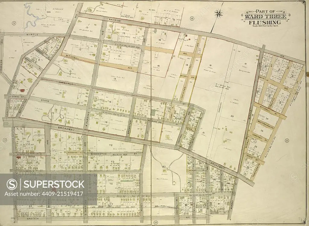
Queens, Vol. 3, Double Page Plate No. 7; Part of ward Three Flushing. Map bounded by Congress Ave., Myrtle Ave., Bayside Ave., Whitestone Ave., S. Parsons Ave., N. Parsons Ave., Bowne Ave., Brewster Ave., Claverly Pl., Vanriper Ave., Centra.
SuperStock offers millions of photos, videos, and stock assets to creatives around the world. This image of Explore Historic Flushing: Detailed Vintage Map Revealing Historic Streets and Landmarks in Queens, New York by quintlox/Album Archivo/Album is available for licensing today.
Looking for a license?
Click here, and we'll help you find it! Questions? Just ask!
Click here, and we'll help you find it! Questions? Just ask!
DETAILS
Image Number: 4409-21519417Rights ManagedCredit Line:quintlox/Album Archivo/Album/SuperStockCollection:Album Archivo Contributor:quintlox Model Release:NoProperty Release:NoResolution:5855×4290