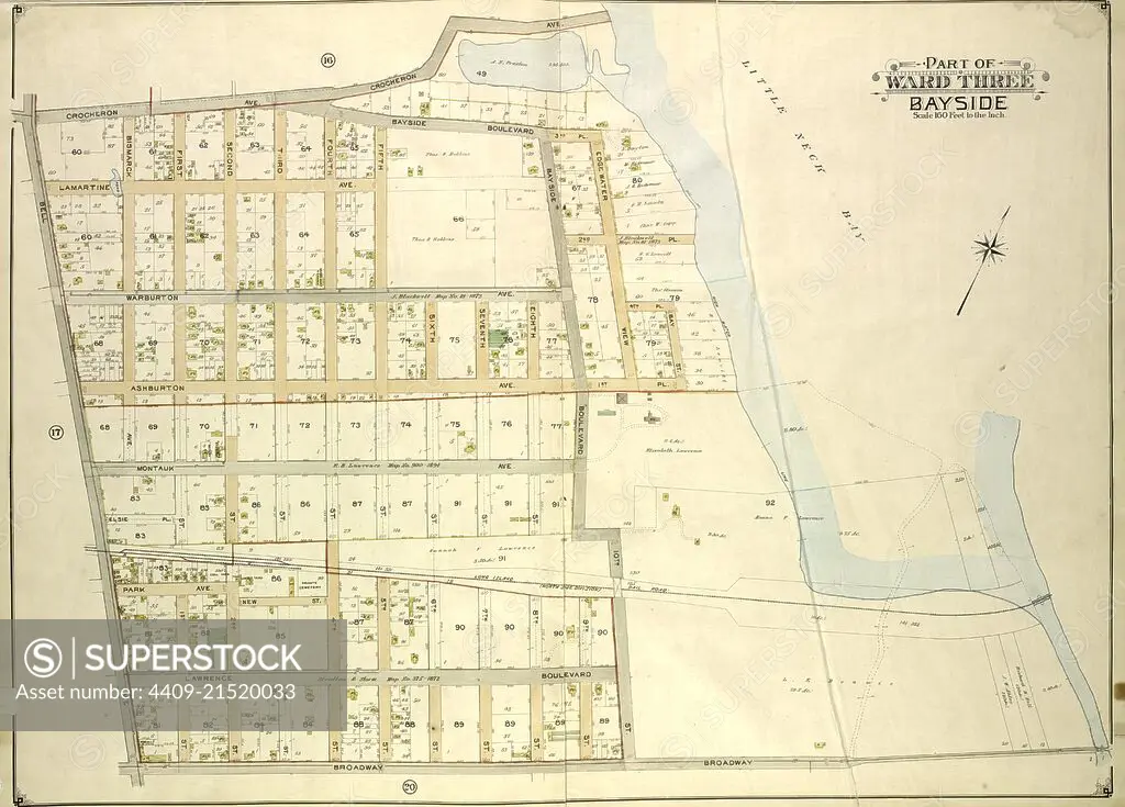
Queens, Vol. 3, Double Page Plate No. 18; Part of ward Three Bayside; Map bounded by Crocheron Ave., Bayside Boulevard, Bell Ave., Bismarck Ave., Lamartine Ave., Warburton Ave., Ashburton Ave., Montauk Ave., Lawrence Boulevard, Broadway,.
SuperStock offers millions of photos, videos, and stock assets to creatives around the world. This image of Explore Historic Bayside Area: Detailed 1873 Map Showcasing Edward Tibbits' Visionary Layout by quintlox/Album Archivo/Album is available for licensing today.
Looking for a license?
Click here, and we'll help you find it! Questions? Just ask!
Click here, and we'll help you find it! Questions? Just ask!
DETAILS
Image Number: 4409-21520033Rights ManagedCredit Line:quintlox/Album Archivo/Album/SuperStockCollection:Album Archivo Story:Historic Cadastral MapsContributor:quintlox Model Release:NoProperty Release:NoResolution:5970×4284