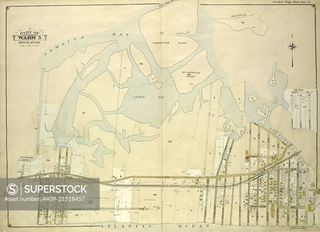
Queens, Vol. 1, Double Page Plate No. 35; Part of Ward 5; Rockaway; Map bounded by Jamaica Bay, Charmttoir Island, Mc. Caffertys Island, Nortons Creek, Hudson Ave., Columbus Ave., Rochester Ave., Wave Crest Ave., Surf Ave., Grand-View Ave., B.
SuperStock offers millions of photos, videos, and stock assets to creatives around the world. This image of Explore Historic Maps: Discover the Intricate Cartography of 1873 Jamaica Bay and Rockaway, New York – A Glimpse into the Past. by quintlox/Album Archivo/Album is available for licensing today.
Looking for a license?
Click here, and we'll help you find it! Questions? Just ask!
Click here, and we'll help you find it! Questions? Just ask!
DETAILS
Image Number: 4409-21518457Rights ManagedCredit Line:quintlox/Album Archivo/Album/SuperStockCollection:Album Archivo Contributor:quintlox Model Release:NoProperty Release:NoResolution:5885×4271