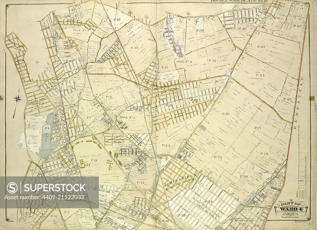
Queens, Vol. 1, Double Page Plate No. 18; Part of Ward 4; Jamaica; Map bounded by South St., Country Road, Old Country Road, Jamaica Plank Road; Including Boundary Line Of City Of New York, Ocean Ave., Farmers Ave., Rockaway Turnpike, Th.
SuperStock offers millions of photos, videos, and stock assets to creatives around the world. This image of Explore Historic Cartography: Vintage 1873 Map of Nassau County, New York – Discover the Rich Heritage and Architectural Evolution. by quintlox/Album Archivo/Album is available for licensing today.
Looking for a license?
Click here, and we'll help you find it! Questions? Just ask!
Click here, and we'll help you find it! Questions? Just ask!
DETAILS
Image Number: 4409-21522033Rights ManagedCredit Line:quintlox/Album Archivo/Album/SuperStockCollection:Album Archivo Contributor:quintlox Model Release:NoProperty Release:NoResolution:5910×4284