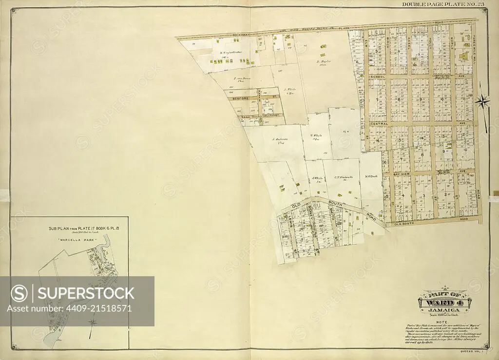
Queens, Vol. 1, Double Page Plate No. 23; Part of Ward 4; Jamaica; Map bounded by Rockaway Plank road, Three Mile Mill Road, Old South Road; Including Smith St., Sidney St., Lewis St., Bank St., Bedford St.; Sub Plan From Plate 17, Book 6, Pla.
SuperStock offers millions of photos, videos, and stock assets to creatives around the world. This image of Explore Historical Land Maps: Detailed Vintage Map of Richmond County, New York, Highlighting Neighborhood Boundaries and Landmarks by quintlox/Album Archivo/Album is available for licensing today.
Looking for a license?
Click here, and we'll help you find it! Questions? Just ask!
Click here, and we'll help you find it! Questions? Just ask!
DETAILS
Image Number: 4409-21518571Rights ManagedCredit Line:quintlox/Album Archivo/Album/SuperStockCollection:Album Archivo Contributor:quintlox Model Release:NoProperty Release:NoResolution:5904×4259