Queens, Vol. 2, Double Page Plate No. 5; Part of Long Island City Ward One Part of Old Ward 2 Newtown Ward Two; Map bounded by Woodside Ave., Celtic Ave. Highway to Calvary Cemetery, Thomson Ave.; Including Greenpoint Ave., Bushwick.
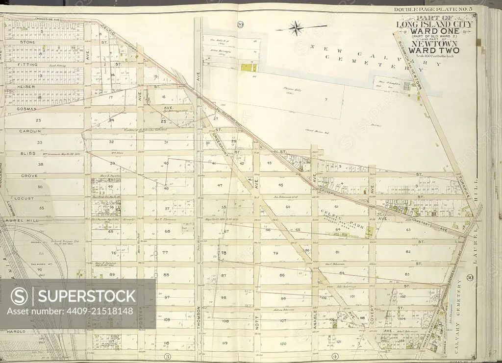
SuperStock offers millions of photos, videos, and stock assets to creatives around the world. This image of Explore Historical Cartography: Vintage 1900 Map of Long Island City, Ward One and Ward Two – Discover the Past Layout and Urban Development! by quintlox/Album Archivo/Album is available for licensing today.
Looking for a license?
Click here, and we'll help you find it! Questions? Just ask!
Click here, and we'll help you find it! Questions? Just ask!
DETAILS
Image Number: 4409-21518148Rights ManagedCredit Line:quintlox/Album Archivo/Album/SuperStockCollection:Album Archivo Contributor:quintlox Model Release:NoProperty Release:NoResolution:6058×4384