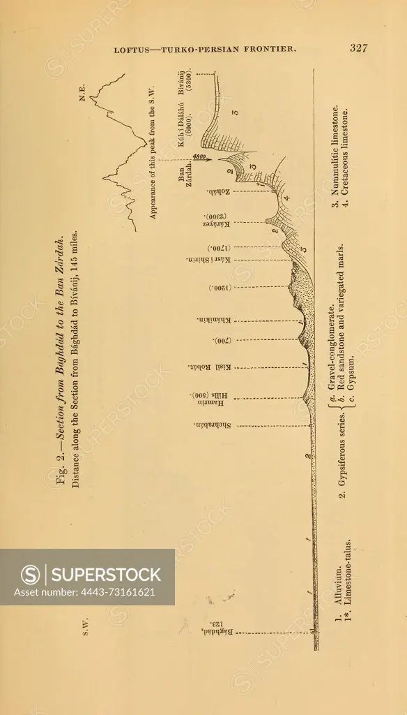
The Quarterly Journal of the Geological Society of London. v. 11 (1855). London, Geology, Periodicals, The illustration presents a detailed topographic profile of the Turko-Persian frontier, showcasing various geographical features and elevations along the route from the region labeled as 'Bayazid' to 'Evan Zard.' Marked points indicate significant locations, including cities and natural landmarks, with distances noted from a base reference. The elevation contour lines visually represent the changes in terrain, highlighting valleys, hills, and peaks. Various annotations provide additional context regarding specific geographical characteristics and historical notes relevant to the area. The diagram serves as a valuable reference for understanding the topography and strategic significance of the frontier region.
SuperStock offers millions of photos, videos, and stock assets to creatives around the world. This image of The Quarterly Journal of the Geological Society of London. v. 11 (1855). London, Geology, Periodicals, The illustration presents a detailed topographic profile of the Turko-Persian frontier, showcasing various geographical features and elevations along the route from the region labeled as 'Bayazid' to 'Evan Zard.' Marked points indicate significant locations, including cities and natural landmarks, with distances noted from a base reference. The elevation contour lines visually represent the changes in terrain, highlighting valleys, hills, and peaks. Various annotations provide additional context regarding specific geographical characteristics and historical notes relevant to the area. The diagram serves as a valuable reference for understanding the topography and strategic significance of the frontier region. by Artokoloro is available for licensing today.
Looking for a license?
Click here, and we'll help you find it! Questions? Just ask!
Click here, and we'll help you find it! Questions? Just ask!
DETAILS
Image Number: 4443-73161621Rights ManagedCredit Line:Artokoloro/SuperStockCollection:Artokoloro Model Release:NoProperty Release:NoResolution:3326×5822