The Quarterly Journal of the Geological Society of London, v. 11 (1855), London, geology, periodicals, historical map, The illustration depicts a detailed geological map showcasing the distribution of land surfaces beneath drift deposits. It highlights various topographical features, such as contours and elevations, with annotations indicating locations of specific geological formations. The map also includes a legend that explains different symbols used to represent various land types and conditions, emphasizing the intricate relationship between the surface and subsurface geological structures. The overall layout facilitates an understanding of geological history and the processes that have shaped the terrain.
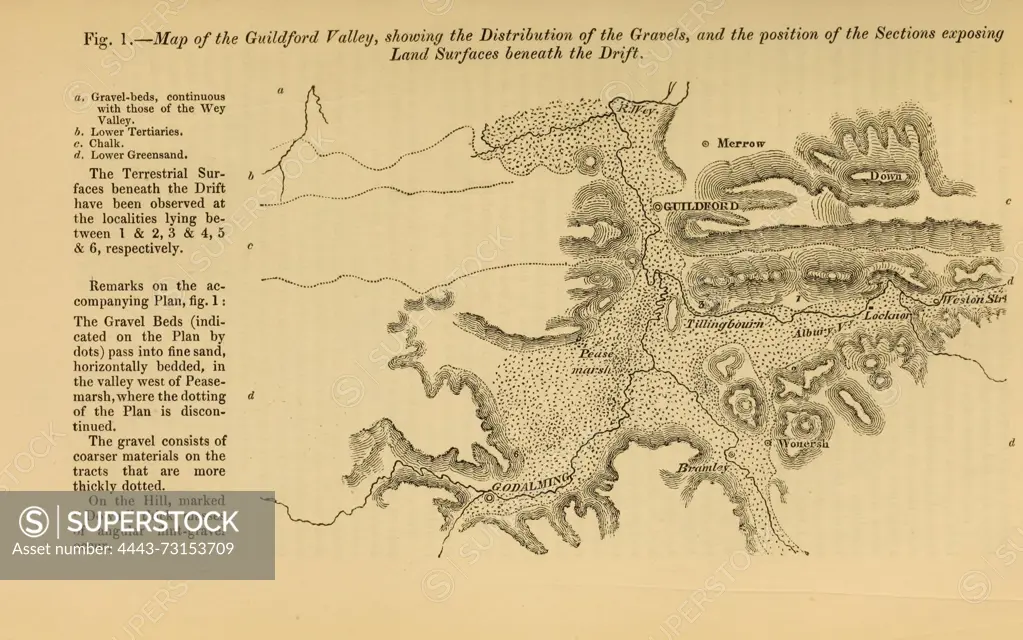
SuperStock offers millions of photos, videos, and stock assets to creatives around the world. This image of The Quarterly Journal of the Geological Society of London, v. 11 (1855), London, geology, periodicals, historical map, The illustration depicts a detailed geological map showcasing the distribution of land surfaces beneath drift deposits. It highlights various topographical features, such as contours and elevations, with annotations indicating locations of specific geological formations. The map also includes a legend that explains different symbols used to represent various land types and conditions, emphasizing the intricate relationship between the surface and subsurface geological structures. The overall layout facilitates an understanding of geological history and the processes that have shaped the terrain. by Artokoloro is available for licensing today.
Looking for a license?
Click here, and we'll help you find it! Questions? Just ask!
Click here, and we'll help you find it! Questions? Just ask!
DETAILS
Image Number: 4443-73153709Rights ManagedCredit Line:Artokoloro/SuperStockCollection:Artokoloro Model Release:NoProperty Release:NoResolution:5312×3325