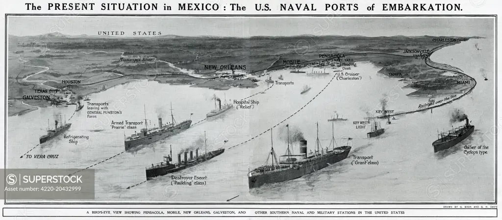
The present situation in Mexico: the US naval ports of embarkation. An aerial view, showing Pensacola, Mobile, New Orleans, Galveston and other southern naval and military stations in the United States. Hostilities had been suspended, pending the outcome of a mediation conference. Date: May 1914
SuperStock offers millions of photos, videos, and stock assets to creatives around the world. This image of Vintage Map of U.S. Naval Ports for Embarkation During Mexico Conflict – Historical Maritime Routes and Strategy by Illustrated London News Ltd/Mary Evans Picture Library/Pantheon is available for licensing today.
Looking for a license?
Click here, and we'll help you find it! Questions? Just ask!
Click here, and we'll help you find it! Questions? Just ask!
DETAILS
Image Number: 4220-20432999Rights ManagedCredit Line:Illustrated London News Ltd/Mary Evans Picture Library/Pantheon/SuperStockCollection:Mary Evans Picture Library Contributor:Illustrated London News Ltd Model Release:NoProperty Release:NoResolution:8028×3534