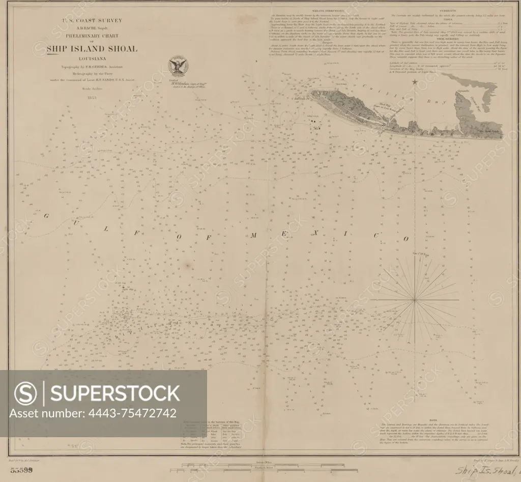
Preliminary chart of Ship Island Shoal, Louisiana, 1853. United States Coast Survey. Additional, Ship Island Shoal, Louisiana., 1853., Washington, D.C. Publisher, U.S. Coast Survey Office. Nautical charts, Louisiana, Ship Shoal, Banks (Oceanography), Louisiana, Isles Dernieres, Banks (Oceanography), Mexico, Gulf of, Isles Dernieres (La.)., 1 map; 39 x 43 cm, on sheet 47 x 56 cm
SuperStock offers millions of photos, videos, and stock assets to creatives around the world. This image of Preliminary chart of Ship Island Shoal, Louisiana, 1853. United States Coast Survey. Additional, Ship Island Shoal, Louisiana., 1853., Washington, D.C. Publisher, U.S. Coast Survey Office. Nautical charts, Louisiana, Ship Shoal, Banks (Oceanography), Louisiana, Isles Dernieres, Banks (Oceanography), Mexico, Gulf of, Isles Dernieres (La.)., 1 map; 39 x 43 cm, on sheet 47 x 56 cm by Artokoloro is available for licensing today.
Looking for a license?
Click here, and we'll help you find it! Questions? Just ask!
Click here, and we'll help you find it! Questions? Just ask!
DETAILS
Image Number: 4443-75472742Rights ManagedCredit Line:Artokoloro/SuperStockCollection:Artokoloro Model Release:NoProperty Release:NoResolution:5700×5273