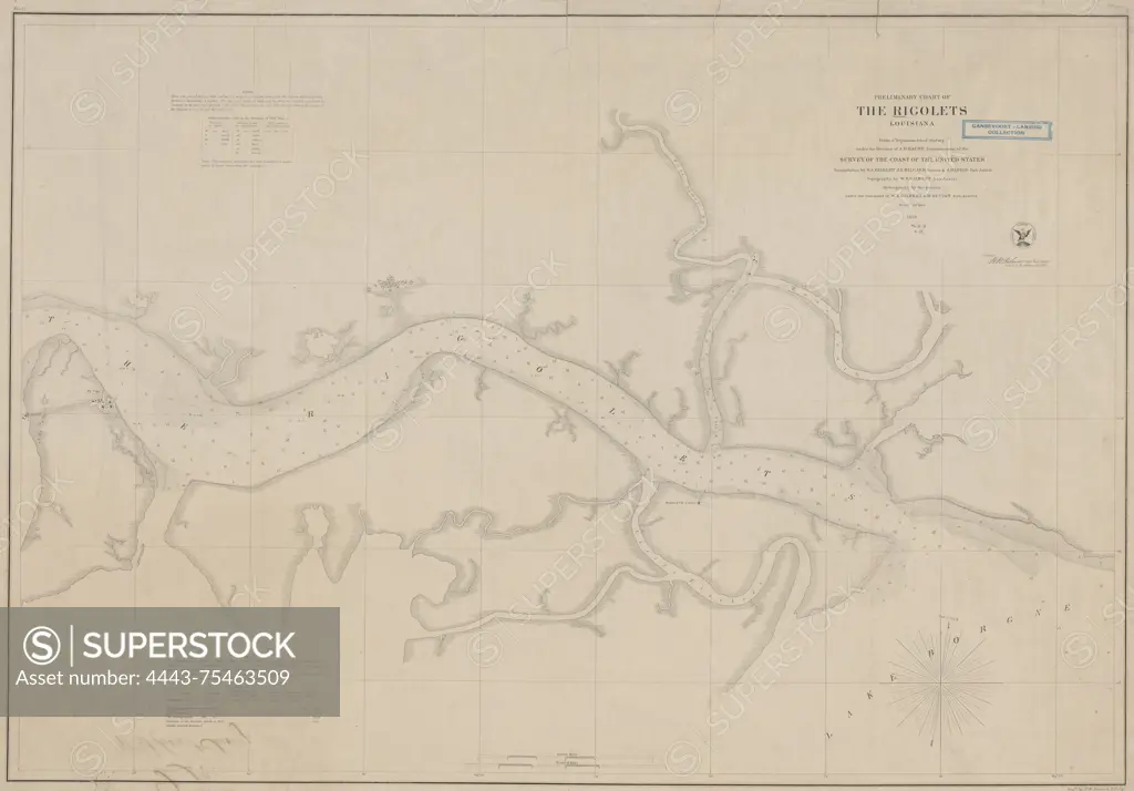
Preliminary chart of the Rigolets, Louisiana, 1859, U.S. Coast Survey., 1859., Washington, D.C. Publisher, U.S. Coast Survey Office. Nautical charts, Louisiana, Rigolets, Fort Pike Region (La.), Fort Pike (La.)., 1 map; 53 x 77 cm, on sheet 60 x 84 cm
SuperStock offers millions of photos, videos, and stock assets to creatives around the world. This image of Preliminary chart of the Rigolets, Louisiana, 1859, U.S. Coast Survey., 1859., Washington, D.C. Publisher, U.S. Coast Survey Office. Nautical charts, Louisiana, Rigolets, Fort Pike Region (La.), Fort Pike (La.)., 1 map; 53 x 77 cm, on sheet 60 x 84 cm by Artokoloro is available for licensing today.
Looking for a license?
Click here, and we'll help you find it! Questions? Just ask!
Click here, and we'll help you find it! Questions? Just ask!
DETAILS
Image Number: 4443-75463509Rights ManagedCredit Line:Artokoloro/SuperStockCollection:Artokoloro Model Release:NoProperty Release:NoResolution:5700×3975