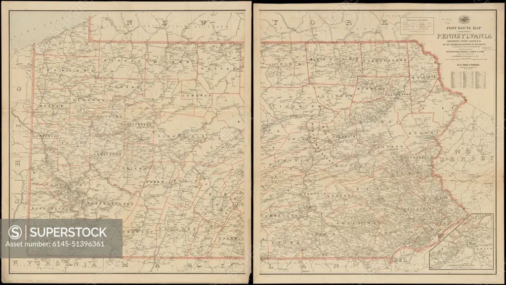
Post route map of the state of Pennsylvania showing post offices and the intermediate distances on mail routes in operation on the 1st. of September, 1897 , Counties, Pennsylvania, Maps, Postal service, Pennsylvania, Maps, Railroads, Pennsylvania, Maps, Pennsylvania, Maps Norman B. Leventhal Map Center Collection
SuperStock offers millions of photos, videos, and stock assets to creatives around the world. This image of Post route map of the state of Pennsylvania showing post offices and the intermediate distances on mail routes in operation on the 1st. of September, 1897 , Counties, Pennsylvania, Maps, Postal service, Pennsylvania, Maps, Railroads, Pennsylvania, Maps, Pennsylvania, Maps Norman B. Leventhal Map Center Collection by piemags/PL Photography Limited is available for licensing today.
Looking for a license?
Click here, and we'll help you find it! Questions? Just ask!
Click here, and we'll help you find it! Questions? Just ask!
DETAILS
Image Number: 6145-51396361Royalty FreeCredit Line:piemags/PL Photography Limited/SuperStockCollection:PL Photography Limited Story:Antique Maps CollectionContributor:piemags Model Release:NoProperty Release:NoResolution:22742×12822