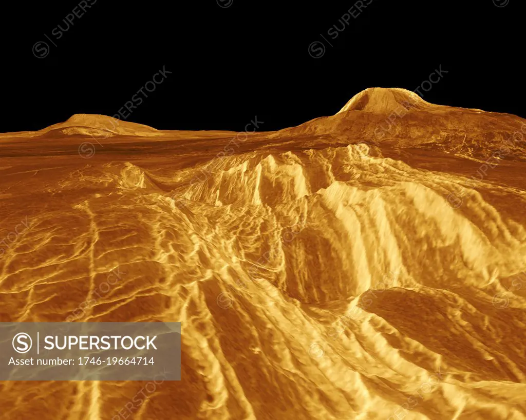
A portion of western Eistla Regio is shown in this three dimensional, computer-generated view of the surface of Venus. The viewpoint is at an elevation of 1.2 kilometres (0.75 mile) at a location 700 kilometres (435 miles) southeast of Gula Mons, the volcano on the right horizon. Gula Mons reaches 3 kilometres (1.8 miles) high and is located around 22 degrees north latitude and 359 degrees east longitude. Sif Mons, the volcano on the left horizon, has a diameter of 300 kilometres (186 miles) and a height of 2 kilometres (1.2 miles). Magellan imaging and altimetry data are combined to develop a three-dimensional computer view of the planets surface. Simulated colour based on colour images from the Soviet Venera 13 and 14 spacecraft is added to enhance small-scale structure.1990.
SuperStock offers millions of photos, videos, and stock assets to creatives around the world. This image of A portion of western Eistla Regio is shown in this three dimensional, computer-generated view of the surface of Venus. The viewpoint is at an elevation of 1.2 kilometres (0.75 mile) at a location 700 kilometres (435 miles) southeast of Gula Mons, the volcano on the right horizon. Gula Mons reaches 3 kilometres (1.8 miles) high and is located around 22 degrees north latitude and 359 degrees east longitude. Sif Mons, the volcano on the left horizon, has a diameter of 300 kilometres (186 miles) and a height of 2 kilometres (1.2 miles). Magellan imaging and altimetry data are combined to develop a three-dimensional computer view of the planets surface. Simulated colour based on colour images from the Soviet Venera 13 and 14 spacecraft is added to enhance small-scale structure.1990. by World History Archive/Image Asset Management is available for licensing today.
Looking for a license?
Click here, and we'll help you find it! Questions? Just ask!
Click here, and we'll help you find it! Questions? Just ask!
DETAILS
Image Number: 1746-19664714Rights ManagedCredit Line:World History Archive/Image Asset Management/SuperStockCollection:Image Asset Management Contributor:World History Archive Model Release:NoProperty Release:NoResolution:5000×4000