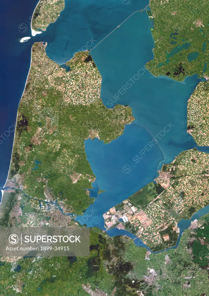
Polders, Netherlands, True Colour Satellite Image. Polders in the Netherlands, true colour satellite image. Polders are land reclaimed from the sea, using dikes and dunes, that are drained to expand the Dutch territory and for use as farmland. Image taken on 1 July 1994 using LANDSAT data.
SuperStock offers millions of photos, videos, and stock assets to creatives around the world. This image of Polders, Netherlands, True Colour Satellite Image. Polders in the Netherlands, true colour satellite image. Polders are land reclaimed from the sea, using dikes and dunes, that are drained to expand the Dutch territory and for use as farmland. Image taken on 1 July 1994 using LANDSAT data. by Universal Images is available for licensing today.
Looking for a license?
Click here, and we'll help you find it! Questions? Just ask!
Click here, and we'll help you find it! Questions? Just ask!
DETAILS
Image Number: 1899-34915Rights ManagedCredit Line:Universal Images/SuperStockCollection:Universal Images Model Release:NoProperty Release:NoResolution:3508×4962