1887 Pocket Map Version of the U.S. Geological Survey Map of Gloucester and Rockport, Massachusetts
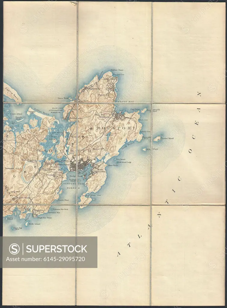
SuperStock offers millions of photos, videos, and stock assets to creatives around the world. This image of Explore Historical Cartography: Antique Map of the Atlantic Ocean and Coastal Regions by Piemags/PL Photography Limited is available for licensing today.
Looking for a license?
Click here, and we'll help you find it! Questions? Just ask!
Click here, and we'll help you find it! Questions? Just ask!
DETAILS
Image Number: 6145-29095720Royalty FreeCredit Line:Piemags/PL Photography Limited/SuperStockCollection: