Plattegrond van Rome, ca. 1702; Plan of the city of Rome; The forces of Europe, Asia, Africa and America, or description of the main cities with their fortifications. Designed by the best ingesters, especially those under the domination of France (...) and adorned with several superb buildings.Map of Rome. Plate No. 201 in The Picture In The Context of 276 Numbered Plates of Renowned Strong Cities and Fortresses in The Context of the Spanish Succession War. For Most Part, These Plates Have Been Cophed to the Anonymous French Flat: In The Forces of Europe and In: The Theater of War, The Netherlands, Both Originally Published by Nicolas de Iron in Paris (1693-1697 In the Framework of the Nine-Year War. Title and registrations in the flat in French.
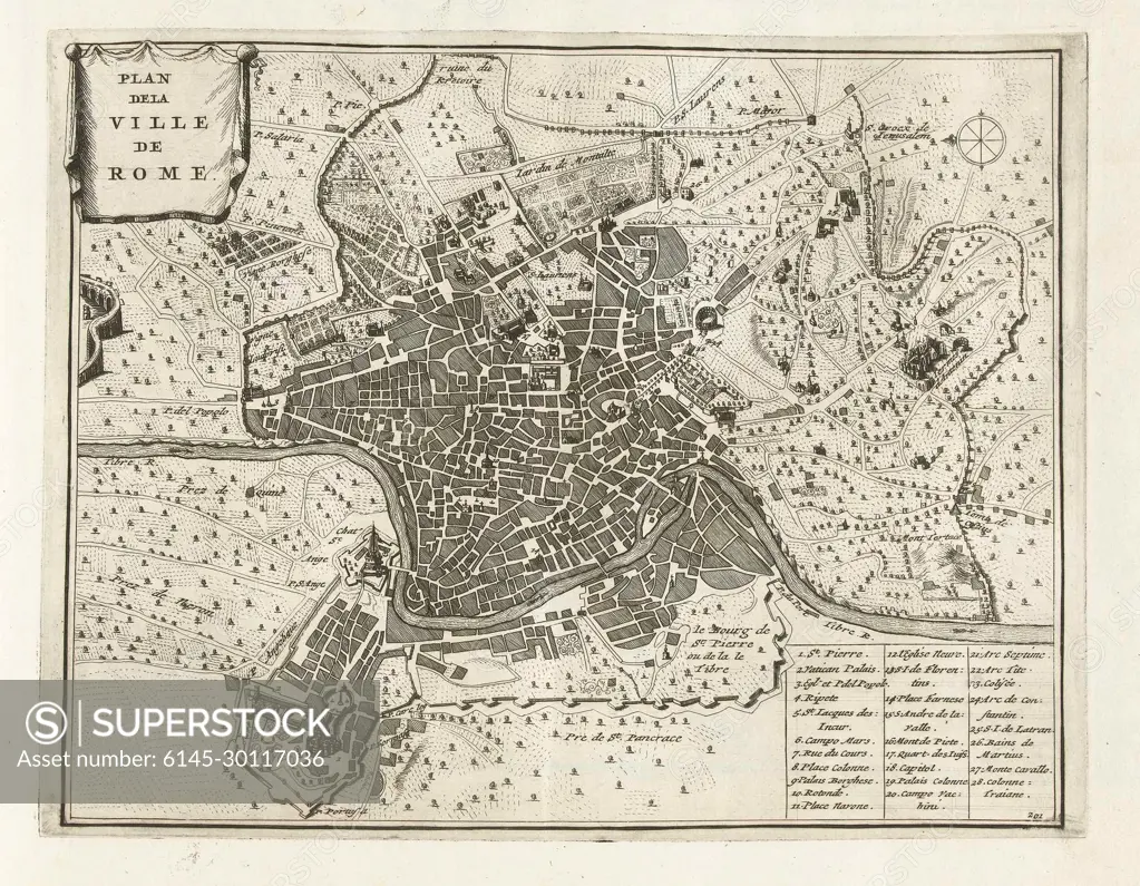
SuperStock offers millions of photos, videos, and stock assets to creatives around the world. This image of Plattegrond van Rome, ca. 1702; Plan of the city of Rome; The forces of Europe, Asia, Africa and America, or description of the main cities with their fortifications. Designed by the best ingesters, especially those under the domination of France (...) and adorned with several superb buildings.Map of Rome. Plate No. 201 in The Picture In The Context of 276 Numbered Plates of Renowned Strong Cities and Fortresses in The Context of the Spanish Succession War. For Most Part, These Plates Have Been Cophed to the Anonymous French Flat: In The Forces of Europe and In: The Theater of War, The Netherlands, Both Originally Published by Nicolas de Iron in Paris (1693-1697 In the Framework of the Nine-Year War. Title and registrations in the flat in French. by Piemags/PL Photography Limited is available for licensing today.
Looking for a license?
Click here, and we'll help you find it! Questions? Just ask!
Click here, and we'll help you find it! Questions? Just ask!
DETAILS
Image Number: 6145-30117036Royalty FreeCredit Line:Piemags/PL Photography Limited/SuperStockCollection:PL Photography Limited Contributor:Piemags Model Release:NoProperty Release:NoResolution:1988×1545